Two Range Pole Mode
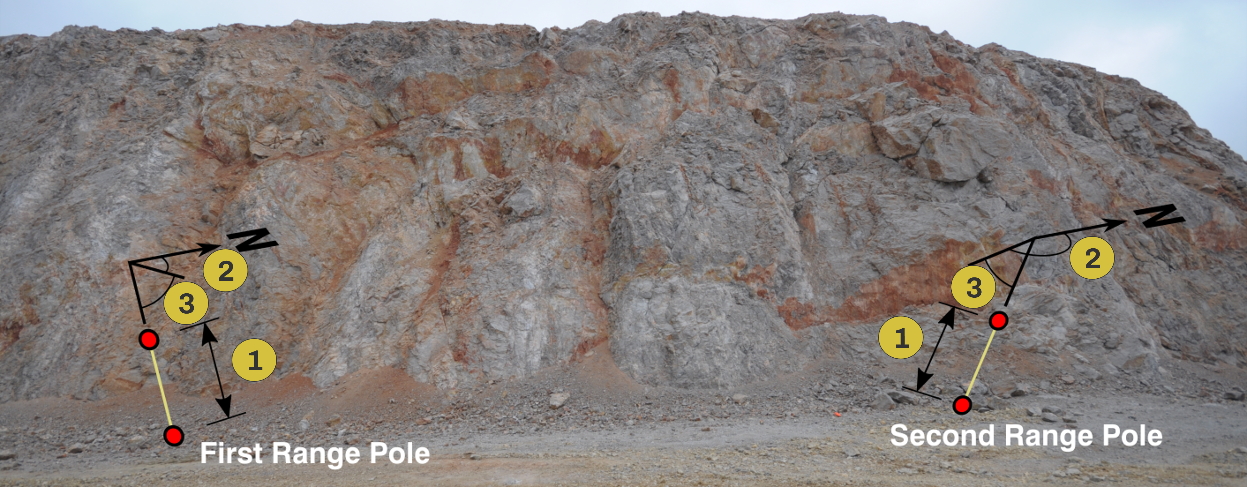
The Two Range Pole Mode features scaling, vertically orientating, and north-correcting at the same time using two non-parallel Range Poles visible in the photos. This mode requires as input the distance between the Range Pole targets and the trend and plunge of the two Range Poles. It is possible to have the same target distances for both, Range Poles or different target distances, for each of the Range Poles. The trend and plunge of the Range Poles have to be determined in the field, e.g. using a geologic compass (Clar or Brunton).
- Range Pole target distance
- Trend of Range Poles
- Plunge of Range Poles
Surveyed Control Point (optional)
Co-ordinates of a surveyed GCP can be defined. This mode is also used to shift the 3D model to a position in space. The Ground Control Point might be an artificial target or natural or marked points on the rock face. Co-ordinates (Easting, Northing, Height) must be known for using a surveyed GCP.