ShapeMetriX

Photogrammetry & Geological Mapping Software

Provides contact-free geological mapping, rock mass characterization and 3D geometry measurements for both surface and underground rock applications. 
Free Trial

ShapeMetriX

Photogrammetry & Geological Mapping Software

Free Trial

Generate Accurate & High-Resolution 3D Models 

Generate comprehensive, highly accurate and high-resolution 3D models of slopes, outcrops, excavations, underground openings and exposed faces at all scales from aerial and terrestrial imagery or existing point cloud data, even when human access is impossible.

ShapeMetriX
ShapeMetriX

Generate Accurate & High-Resolution 3D Models 

Generate comprehensive, highly accurate and high-resolution 3D models of slopes, outcrops, excavations, underground openings and exposed faces at all scales from aerial and terrestrial imagery or existing point cloud data, even when human access is impossible.

ShapeMetriX

Structural Geological Mapping

Enhance the accuracy and efficiency of geologic surveys by direct geometric measurements on 3D models. Utilize automatic, semi-automatic and manual tools for measuring discontinuity orientations, traces, areas, distances, and locations in seconds. Instantly preview structural measurements on stereonet plots, perform automatic joint set clustering, trace map analysis, joint spacing and trace length analysis. 

ShapeMetriX

Structural Geological Mapping

Enhance the accuracy and efficiency of geologic surveys by direct geometric measurements on 3D models. Utilize automatic, semi-automatic and manual tools for measuring discontinuity orientations, traces, areas, distances, and locations in seconds. Instantly preview structural measurements on stereonet plots, perform automatic joint set clustering, trace map analysis, joint spacing and trace length analysis. 

Rock Mass Characterization 

Capture rock mass conditions from outcrops and bench faces to underground excavation walls. Assess rock mass quality with high measurement density, comprehensively record and document geometry of imaged rock walls, measurements of geometric fracture network features and spatial orientations. 

ShapeMetriX
ShapeMetriX

Rock Mass Characterization 

Capture rock mass conditions from outcrops and bench faces to underground excavation walls. Assess rock mass quality with high measurement density, comprehensively record and document geometry of imaged rock walls, measurements of geometric fracture network features and spatial orientations. 

Check out the full list of technical features in ShapeMetriX

ShapeMetriX Across Applications

  • Open Pit Mining
  • Underground Excavations 
  • Transportation
  • Natural Hazards

Open Pit Mining

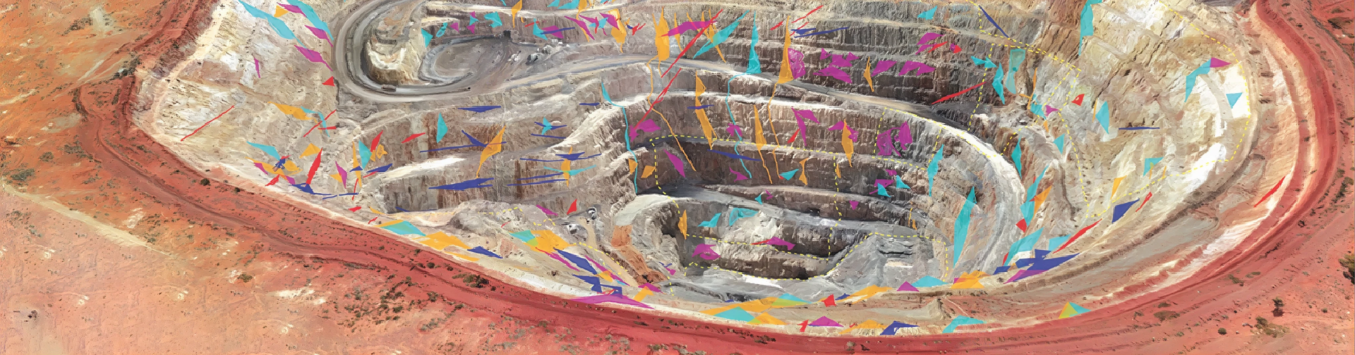
Generate high-resolution 3D models of rock slopes and excavations using drone photogrammetry, terrestrial imagery, or existing point cloud data to accurately capture discontinuity orientations, persistence, spacing, and location without field access or observer bias. Transform contact-free geological mapping and precise 3D geometry measurements into a powerful foundation for geotechnical decision-making.

Open Pit Mining

Underground Excavations 

Generate detailed 3D models of tunnel faces and surrounding geological formations to measure orientations, traces, areas, persistence, and more without direct contact, increasing safety by reducing physical risks and enhancing operational efficiency.

Underground Excavations 

Transportation

Produce high-resolution 3D models that accurately capture terrain and structural geological features along highway cuts, roads, railways, bridges, and other overlying civil infrastructure. Perform structural geological mapping, spatial assessments, and detailed visualizations for effective planning and design.

Transportation

Natural Hazards

Utilize UAVs (drones) and advanced photogrammetry to ensure safe and accurate data collection, structural mapping and documentation in hazardous and difficult-to-access areas. Capture critical details for risk assessment and management, enhancing the ability to monitor and respond to natural hazards effectively.

Natural Hazards

ShapeMetriX Seamlessly Integrates With

  • DIPS
  • RocSlope3
  • RocTunnel3
  • RocFall3
  • FragMetriX
  • BlastMetriX

+

Streamline the workflow from structural geological mapping to stereonet analysis, kinematic analysis, and DFN generation. Export structural maps as custom DIPS-readable *.3gdps files containing key joint information, including dip, dip direction, location, and persistence.

ShapeMetriX

+

Move from geological mapping and rock mass characterization to geotechnical stability and hazard assessment. Directly import slope geometry and measured joint data from ShapeMetriX to RocSlope3 (*.3grs and *.3gdps).

ShapeMetriX

+

Streamline the workflow from field data acquisition and structural geological mapping to 3D block stability analysis for underground excavations. Import underground excavation geometry and measured joint data from ShapeMetriX to RocTunnel3.

ShapeMetriX

+

Import slope geometry from ShapeMetriX to reconstruct the slope surface directly in RocFall3 as part of a comprehensive workflow for rockfall hazard assessment and mitigation.

ShapeMetriX

+

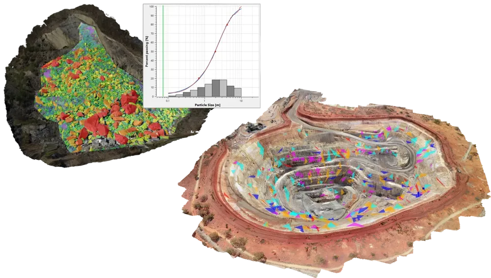
Import photogrammetric 3D models generated in ShapeMetriX directly into FragMetriX for automated fragmentation analysis. Streamline the workflow from 3D data acquisition to accurate particle size distribution analysis using a shared photogrammetric model.

ShapeMetriX

+

Import high-resolution 3D models and geological mapping data from ShapeMetriX into BlastMetriX to streamline the workflow from rock mass characterization to blast design. Utilize accurate bench geometry and structural information to improve burden analysis, drill pattern design, and blast optimization.

ShapeMetriX

The Latest Features

  • Automatic Region Detection

    Automatically identify and map joint surfaces and planar regions on 3D models using a fully automated workflow. Map structural geological features faster and move into structural interpretation with far less manual effort.

  • Add Discontinuity Surfaces

    Assign Discontinuity Surfaces to trace measurements to model the direction and extension of linear fractures, wavy discontinuities, and faults. Adjust the orientation and extension of Discontinuity Surfaces before exporting them in various formats for further geotechnical analysis.

  • Vertical Coordinate Reference System [CRS] Transformation

    Apply vertical geoid correction, converting ellipsoidal heights, typically recorded by GNSS/GPS devices, to gravity-based orthometric heights.

Automatic Region Detection
Add Discontinuity Surfaces
Vertical Coordinate Reference System [CRS] Transformation

Grow With Our Learning Resources

Explore our Learning Resources and User Guides, designed to help you excel with all of your geotechnical projects, whether you are a practicing engineer, an academic or a student.

ShapeMetriX

Get ShapeMetriX today. Choose your license below:

Personal Lease

USD / year
  • One Seat
  • One User Device
  • Cloud-Hosted Licensing
  • Managed in the RocPortal

Flexible+ Lease

USD / year
  • Multiple Seats
  • Unlimited User Devices Per Seat
  • Cloud-Hosted Licensing
  • Managed in the RocPortal
If you’re interested in hosting your flexible lease licenses on a local server, contact us.
Have questions about our pricing structure? View Plans & Pricing FAQ