RSLog

RSLog

Web-based Borehole Log Management
Free Trial
Already have an account? Log in
RSLog

Borehole Data Management

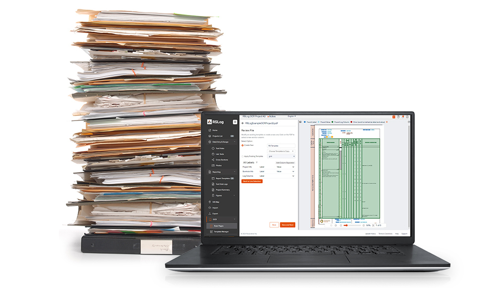
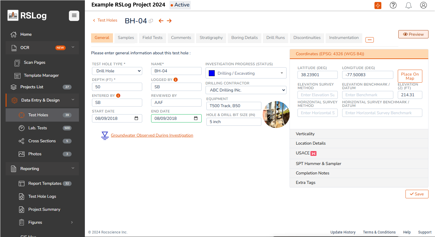
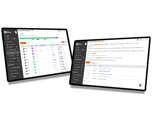
Centralize your borehole data and streamline the process of field data collection, review, and preparation of borehole logs. Designed for geotechnical, environmental, and mining projects with significant amounts of data, RSLog supports various types of soil and rock with over 250 hatch patterns to choose from.

RSLog
RSLog

Borehole Data Management

Centralize your borehole data and streamline the process of field data collection, review, and preparation of borehole logs. Designed for geotechnical, environmental, and mining projects with significant amounts of data, RSLog supports various types of soil and rock with over 250 hatch patterns to choose from.

RSLog

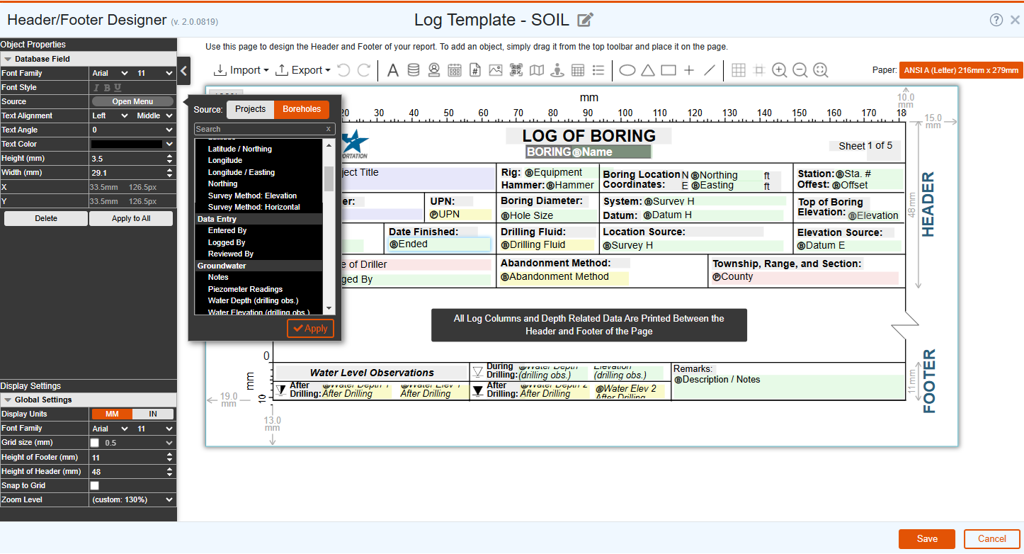
Log Template Design

Designing your borehole logs with the template designer gives you the flexibility to customize the data in your reports, match your templates with your company’s branding, and create unique log templates for different projects and clients. In addition, you can expand the sample types, field tests and other lists in RSLog to match your company’s data collection standards.

Built-in GIS Integration

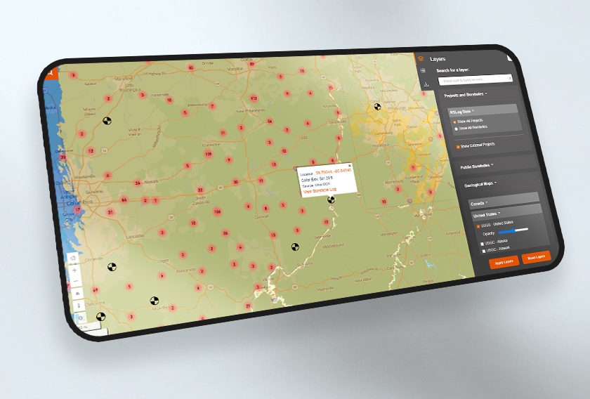
Using the built-in GIS map as a centralized source for all your data, store projects created in RSLog as well as the list of your pre-existing projects (gINT, DIGGS, AGS, Excel files) on a single map, simplifying the way you organize and access your project data.

RSLog
RSLog

Built-in GIS Integration

Using the built-in GIS map as a centralized source for all your data, store projects created in RSLog as well as the list of your pre-existing projects (gINT, DIGGS, AGS, Excel files) on a single map, simplifying the way you organize and access your project data.

Price List

See all features in RSLog

Check out the full list of technical features in RSLog.

See Full Specs
Spec List Spec List
RSLog across Applications
  • Borehole Log Preparation
  • Data Integration
  • Subsurface Visualization

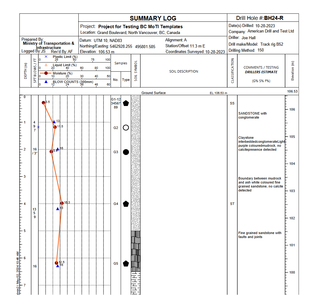
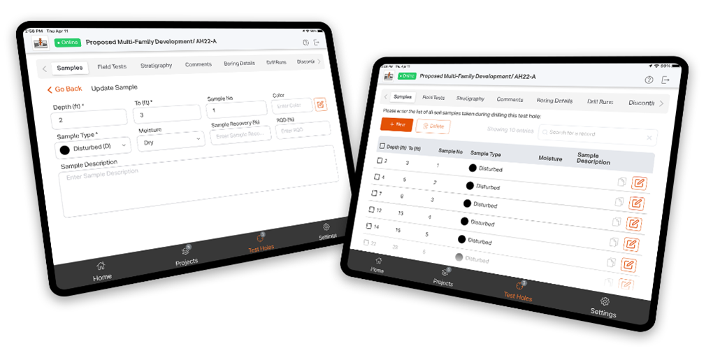
Once your data is in RSLog, any project or borehole related data such as lithologic descriptions, samples, field/laboratory tests results and piezometer/well installation can be presented on the borehole log. Other users in your RSLog account can collaborate by reviewing the draft borehole logs, add comments, and approving the logs.

Borehole Log Preparation - RSLog

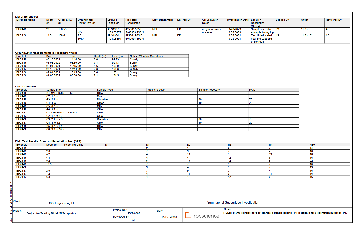
Streamline the process of collecting and transferring data from the field or at the office using any device, with RSLog’s web-based functionality, it’s offline app, and powerful integrations with other applications programs (Slide2, Settle3, gINT, DIGGS, Excel). RSLog also gives you the option to integrate laboratory test results and present them in your borehole logs.

Data Management - RSLog

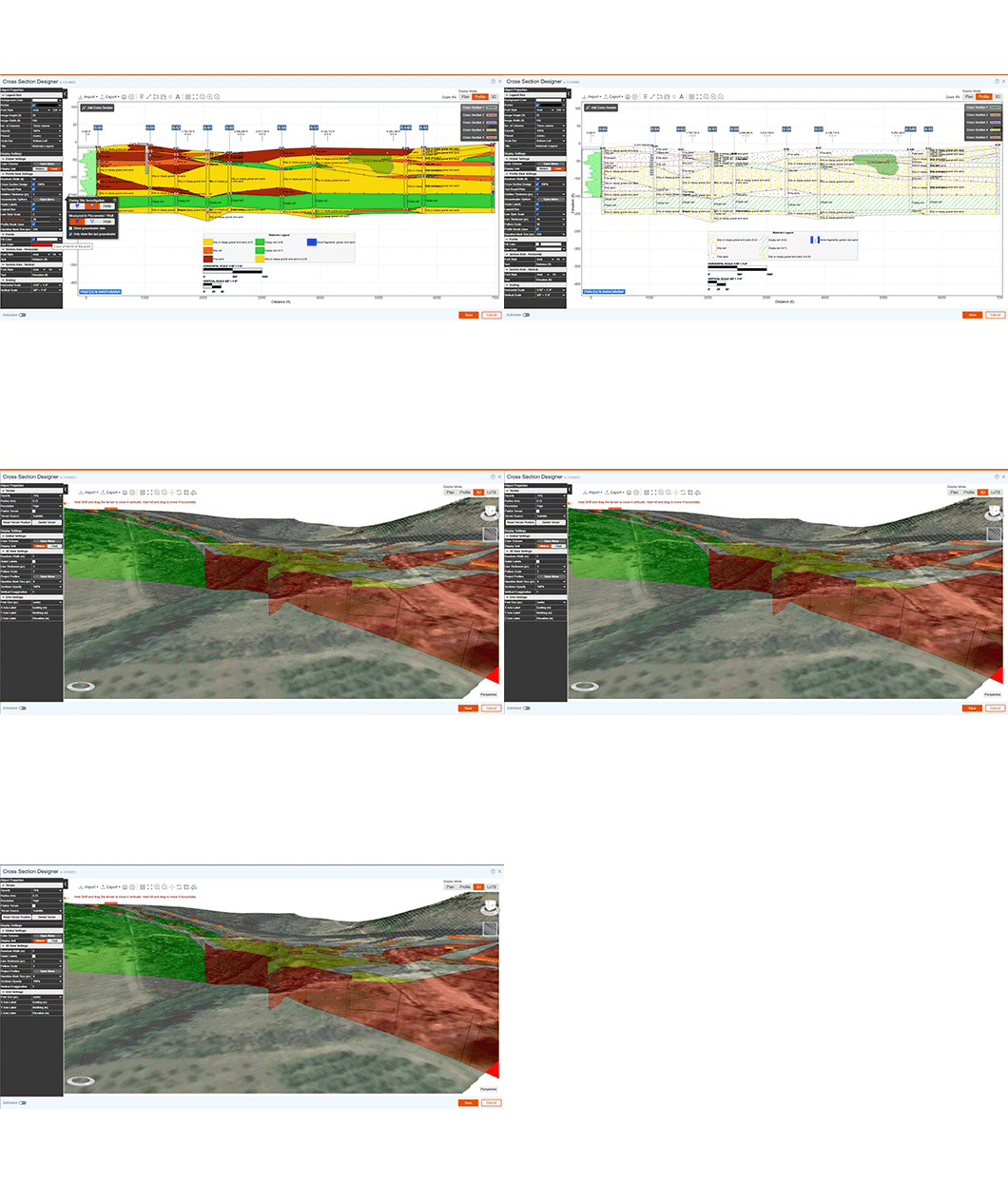
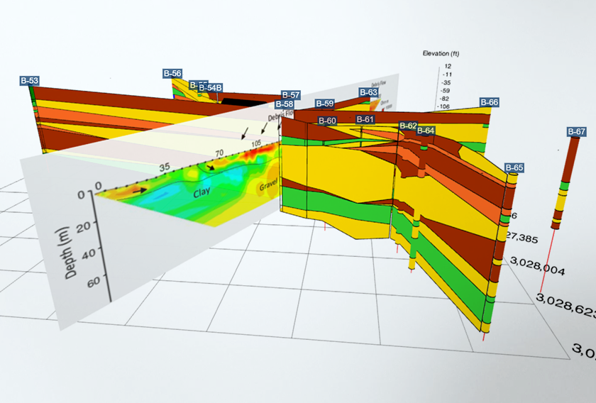
Using the cross-section designer, turn borehole data into cross-sections and visualize subsurface conditions, without the need for other CAD or drafting tools. Connect the layers, apply hatch patterns, indicate underground utilities, show contaminated zones, and view your project cross sections in 3D. Include a topographic terrain model, and export your cross section to various formats (PNG, SVG, DXF, KMZ, etc).

Subsurface Modelling - RSLog
RSLog seamlessly integrates with
RSLog
RSLog

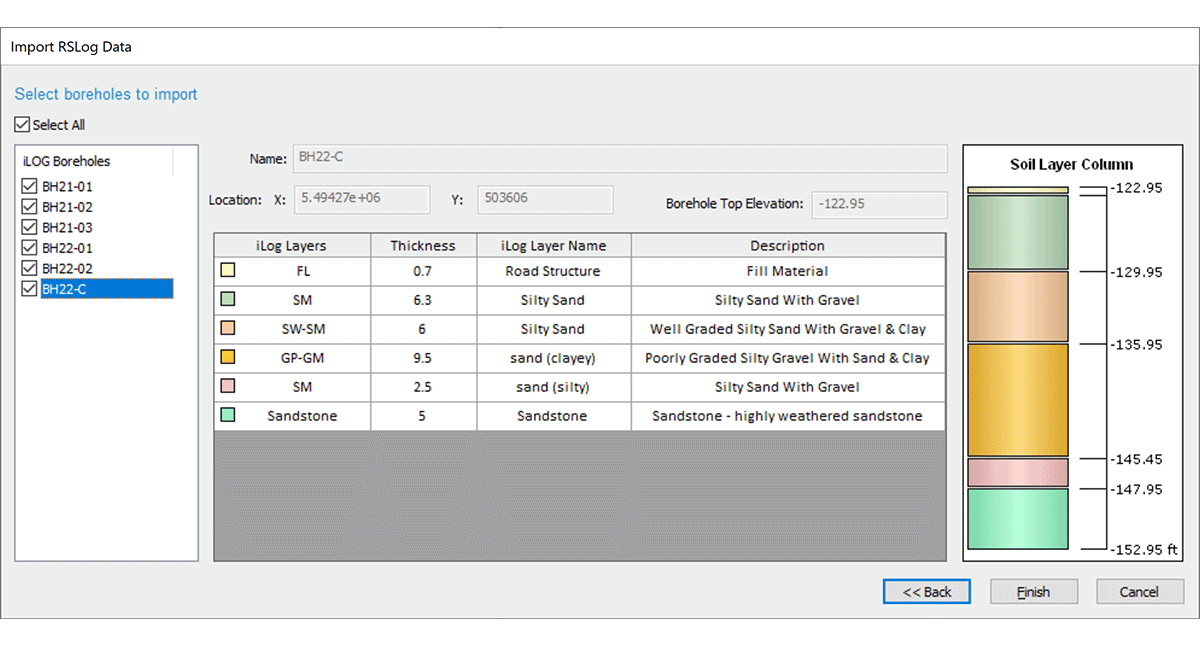
Import borehole data from RSLog directly into Settle3 which can be used to quickly define your soil layers and material properties, without manually inputting data. You can also import field test data (e.g. SPT blow counts) directly from RSLog into your Settle3 project.

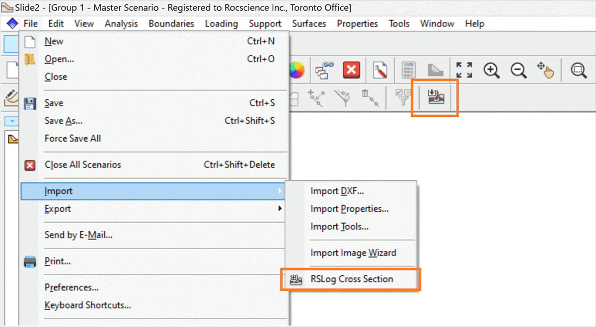
RSLog and Slide2 are now integrated, allowing you to easily import your cross-sections online or offline directly from your RSLog account into Slide2, saving you time.

RSLog

Import borehole data from RSLog directly into Settle3 which can be used to quickly define your soil layers and material properties, without manually inputting data. You can also import field test data (e.g. SPT blow counts) directly from RSLog into your Settle3 project.

RSLog

RSLog and Slide2 are now integrated, allowing you to easily import your cross-sections online or offline directly from your RSLog account into Slide2, saving you time.

Explore the latest features in RSLog
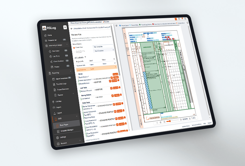
  • Import from DIGGS

    DIGGS (Data Interchange for Geotechnical and Geo-environmental Specialists) is a standard international format for the electronic transfer of geotechnical and geo-environmental data. If your project data is saved in a DIGGS file, use RSLog to import relevant sections of your DIGGS file and generate borehole logs and other types of reports.

  • Project Photo Report

    Save your time with RSLog and create a photo report by one click. All your project photos will be inserted in a photo album downloaded in PDF format. You can select which photos should be included in the report, add a title for each photo and select how many photos will be inserted on each page.

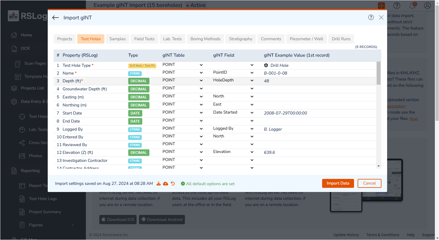
  • Import from gINT

    Import your important geotechnical investigation data from gINT to RSLog as a new project and easily refer to them whenever you need them. This way you can conveniently organize all your gINT project files in one place.

Import from DIGGS - RSLog
Project Photo Report in RSLog
Import from gINT - RSLog
Import from DIGGS - RSLog
Import from DIGGS

DIGGS (Data Interchange for Geotechnical and Geo-environmental Specialists) is a standard international format for the electronic transfer of geotechnical and geo-environmental data. If your project data is saved in a DIGGS file, use RSLog to import relevant sections of your DIGGS file and generate borehole logs and other types of reports.

Project Photo Report in RSLog
Project Photo Report

Save your time with RSLog and create a photo report by one click. All your project photos will be inserted in a photo album downloaded in PDF format. You can select which photos should be included in the report, add a title for each photo and select how many photos will be inserted on each page.

Import from gINT - RSLog
Import from gINT

Import your important geotechnical investigation data from gINT to RSLog as a new project and easily refer to them whenever you need them. This way you can conveniently organize all your gINT project files in one place.

Learn more about all the new features in the latest release of RSLog. Read related article
Learn more about all the new features in the latest release of RSLog.
Grow with our Learning Resources
Explore our Learning Resources and User Guides, designed to help you excel with all of your geotechnical projects, whether you are a practicing engineer, an academic or a student.
article

RSLog - From a Thought to a Web App

article

RSLog - Features and Applications

article

Another step towards software interoperability - Settle3 and RSLog

Plans & Pricing

Lease

Ongoing subscription
USD / year
  • Maintenance+ subscription
  • Ongoing bug fixes
  • Continuous new features
  • Install on one computer
Have questions about our pricing structure? View Plans & Pricing FAQ