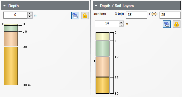
Depth Control
The Depth control in the Sidebar allows you to interactively change the viewing depth for analysis results. This applies to:
- Contours in a horizontal plane in the Plan View and 3D View
- Data along a horizontal line (line query) in the Plan View
- Data at a point (point query) in the Plan View
- Graphs of line query data at a given depth
The depth can be changed in various ways:
- In the Sidebar, click and drag on the vertical slider control which represents the depth of your soil profile
- In the Sidebar, click on the spinner control to increase or decrease the depth, or enter a value with the keyboard
- In the 3D View, you can directly click and drag on the horizontal contour plane to change the depth (hover the mouse at the edge of the horizontal contour plane until you see the two-way arrow cursor, then click and drag)
- In the Sidebar, enter the depth in the input box
As you change the depth, the analysis results in all applicable views will be immediately updated.

Lock Depth
By default, the analysis results in all applicable views will be simultaneously updated as you change the depth. If you wish to view data at different depths in different views, then you can select the Lock Depth  button under the Depth control in the Sidebar. This allows you to independently change the depth in each view (first click in the desired view).
Non-horizontal Soil Profiles
If the Multiple Boreholes option is selected in the Project Settings, then you are also able to change the x,y location of the soil column in the Sidebar. The soil column displayed will correspond to the x,y location specified, and you can change the depth as mentioned above.
Right-click on any point query or borehole and select Set as Soil Legend to set the x,y location in the sidebar to the borehole or query location.