Import Surface Point Cloud
The Import Surface Point Cloud feature expands on Settle3’s ability to generate non-horizontal ground surfaces by allowing users to import a spreadsheet (*.xls) or comma-separated values (*.csv) file containing the X, Y and Z coordinates of a point cloud. Using the existing interpolation methods, Settle3 will construct the ground surface from the imported points along with any boreholes present in the model.
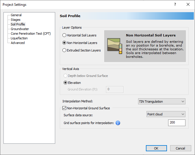
Project Settings
To import surface point cloud data, begin by selecting the following project settings:
- Select Home > Project Settings
 and go to the Soil Profile tab.
 - For the Layer Options, select Non-Horizontal Layers.
- Tick the checkbox for Non-Horizontal Ground Surface.
- For the Surface Data Source, select Point cloud.
- Click OK.
When Point cloud is selected as the Surface data source, the ground surface will be created using the surface point cloud data and boreholes in the model. If there are no boreholes, the surface will be generated solely from the imported point cloud data.
The user has the flexibility to add, delete, and move boreholes. The ground surface will be automatically reconstructed using the updated borehole configuration. The user has the option to select the method of interpolation and the number of grid surface points for interpolation.
Import Surface Point Cloud
To import surface point cloud data:
- Select Soils > Import Surface Points

A sample Excel file (*.xlsx) with point cloud data is shown below. The entries in the input file should be entered in the same format as the example file.
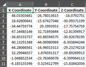
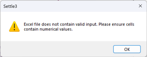
The first row of the spreadsheet is designated for column titles indicating the X, Y, and Z coordinates, as shown. The remaining rows should only contain numerical values for point cloud data. Any rows containing non-numerical entries will not be read and the user will be informed of the invalid row number(s).
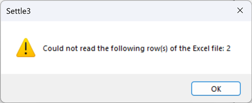
The users are encouraged to revisit the rows flagged in the warning and ensure the input is valid. All remaining valid rows will be imported, and the ground surface will be constructed from these entries. If there are no valid entries to use in the ground surface interpolation, the user will receive a warning and should revise their data.
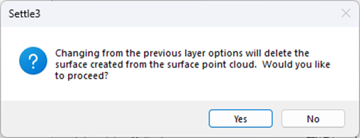
Switching the Surface Data Source
Previously imported point cloud data will be removed if the user switches the Surface data source (in Project Settings) to Boreholes or changes the Layer option to Horizontal Soil Layers or Extruded Section Layers.
The user will need to re-import point cloud data if they decide to switch back to the Point cloud surface data type.
Once the surface point cloud has been successfully imported to Settle3, the user will see the ground surface constructed from their points in the 3D view. Below is an example of a surface created from point cloud data:
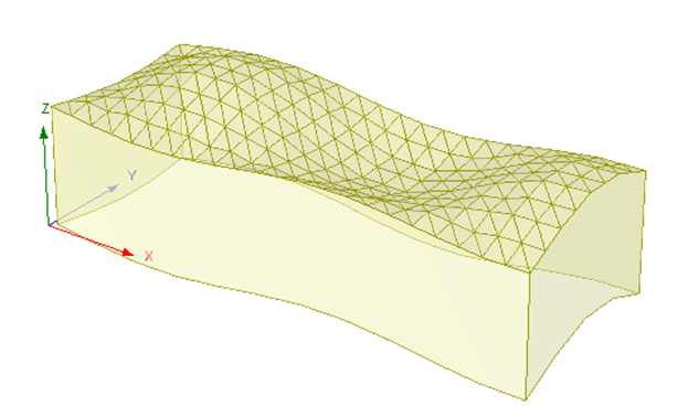 |  |
Example of Ground Surface Generated from Surface Point Cloud Data