CPT Soil Classification
CPT Soil classification dialog shows you the list of CPT points with soil classification and soil layers which shows you the soil layer column.
To see this option, right-click on the CPT data on plan view and select CPT Classification or CPT > Soil Classification  .
.
Soil Classification
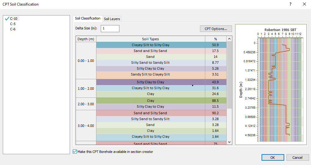
The delta size will determine the depth size which is used to calculate the likelihood of soil type composition with percentage provided for the user. You can select the CPT options which will allow you to specify which Type of CPT classification you want to define along with the Atmospheric pressure (kPa) and Net area Ratio and Cone Factor. You can also apply Filter data. All the parameters used in this dialog is explained more in details in our CPT theory manual.
Depending on the range of input data, some classification may be not defined. For instance, Robertson (1990) or Schneider (2008B) have Normalized Excess Pore Pressure in the x-axis with range of 0.1 to 100. Settle3 will not be able to classify the soil if you have data points out of this range.
Soil Layers
After soil classification has been applied, Settle3 will determine the soil layers with thickness for each soil types along the depth of the CPT point.
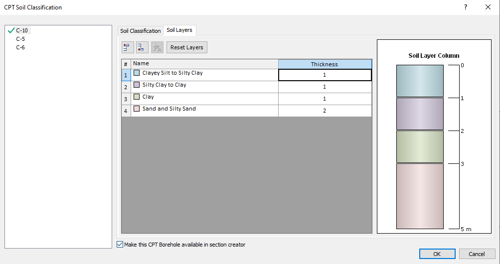
You can also edit this soil profile by adding or removing layers and assign different thickness of this profile.
Also, there's an option to 'make this CPT borehole available in section creator' by selecting the check box below the soil type list. Note that when this box is checked, the soil properties shown in this list are added to soil properties dialog.
Once you select Ok, you'll be prompted with a message that states your soil types are created in the soil properties dialog. Please note that you still need to define the parameters for these soil types as they're filled with default values. After selecting Ok from the message, you’ll be shown the CPT data points with soil profile labels, indicating which CPTs will be shown in the section creator.
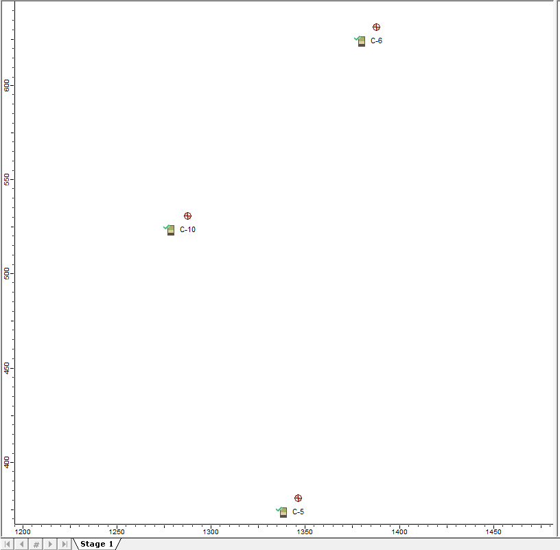
CPT boreholes in section creator
You can enable the section creator by selecting Project settings > Soil Profile > Extruded Section Layers. Then, try to draw the section creator by selecting Soils > Section creator. You can use the CPT boreholes with soil profile as a reference point to draw any shape of soil profile that you want. As mentioned previously, all the soil properties associated with the CPT boreholes are included in the soil properties dialog, making it easier for you to assign soil properties to soil layers.
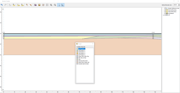
This will create a full 3D soil model using CPT boreholes.
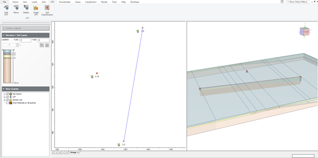
Overall, this feature will let you see the soil profile for each CPT data point using the soil classification chart. Then, these soil profiles can be shown in the section creator for creating a 2D soil profile that will be extruded in 3D for settlement analysis. Please note that it requires engineering judgement to estimate parameters required for settlement analysis (such as mv, Cc, Cr, etc) for the soil material properties.