Field Point Grid Overview
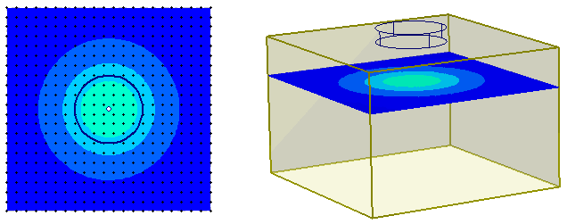
The purpose of the Field Point Grid, is to generate contours of results in a horizontal plane. The Field Point Grid is a regular grid of points which defines a grid of vertical strings in 3-dimensions. The settlement analysis results are computed at intervals along each vertical string, and used to generate contours of settlement and stress in a horizontal plane at any depth.
- You must create a Field Point Grid if you want to view contours of analysis results in a horizontal plane.
- However, a Field Point Grid is not required for a Settle3 analysis. For example, if you only want to obtain results at specific points, or along specific lines or vertical planes, then you can define queries (Point Queries or Line Queries) for this purpose, without necessarily defining a Field Point Grid.
Adding a Field Point Grid
A Field Point Grid is created using either the Auto Field Point Grid option or the Add Field Point Grid option.
Only one Field Point Grid can be defined (it is not possible to define multiple field point grids).
Grid Properties
The number of grid points and the grid expansion factor (Auto Grid option) is defined in the Grid Properties dialog.
Grid Points
In the horizontal plane, a regular grid of points is generated by the Field Point Grid. The actual number of grid points may be slightly different from the value in the Grid Properties dialog, due to the necessity of creating a regular grid spacing.
In the vertical direction, each vertical string is automatically discretized into a number of intervals. The spacing of the analysis intervals is not uniform, but is automatically determined by the program, and depends on the distance from the ground surface (in the vertical direction), and the distance from the loading (in the horizontal direction). Spacing is denser near the ground surface, and near the loading, so that more accurate results are obtained in the zone of interest.
The grid points can be displayed by choosing a grid point symbol in the Query Display Options dialog.
Add Field Points to Load Edges option
The Add field points to load edges option in the Advanced tab of the Project Setttings ensures that field points are placed on the edges of all loads.