GNSS Positioning and CRS Transformation
Both horizontal and vertical transformations are fully supported, including geoid-to-ellipsoid height conversions, ensuring seamless integration of local 3D photogrammetric models with global coordinate systems. Standard operating procedure:
Select “Browse Co-ordinate System from the pull- down menu
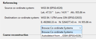
- Specify the co-ordinate system [horizontal and vertical system] in the Select Co-ordinate Reference System dialog and click the “Select” button.
- Select the desired transformation from the “Co-ordinate Reference System Transformation” pull-down menu and check the PROJ-based transformation displayed in the Details section below.
- Optional! Apply a manual, user-defined offset to the transformation by enabling the “Apply Offset” checkbox. Then enter the corresponding values for E, N, and H in the provided fields.
- Confirm the transformation by selecting the “Apply” button.
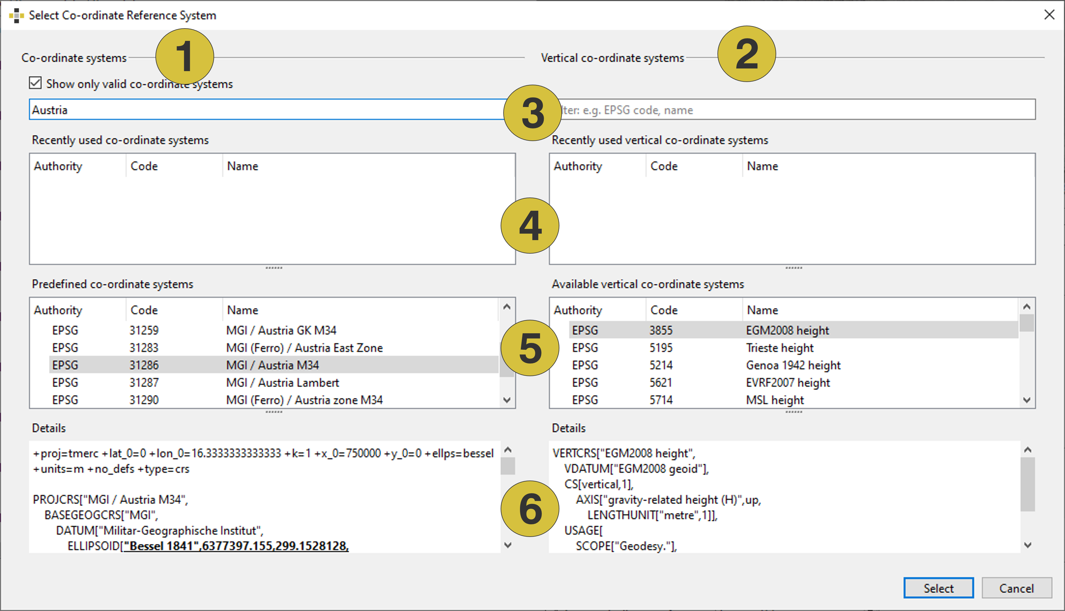
- Destination co-ordinate system [horizontal and if available horizontal]
- Destination co-ordinate system [vertical]
- Filter options
- List of recently used co-ordinate system systems
- List of co-ordinate system systems
- Details of PROJ-based transformation
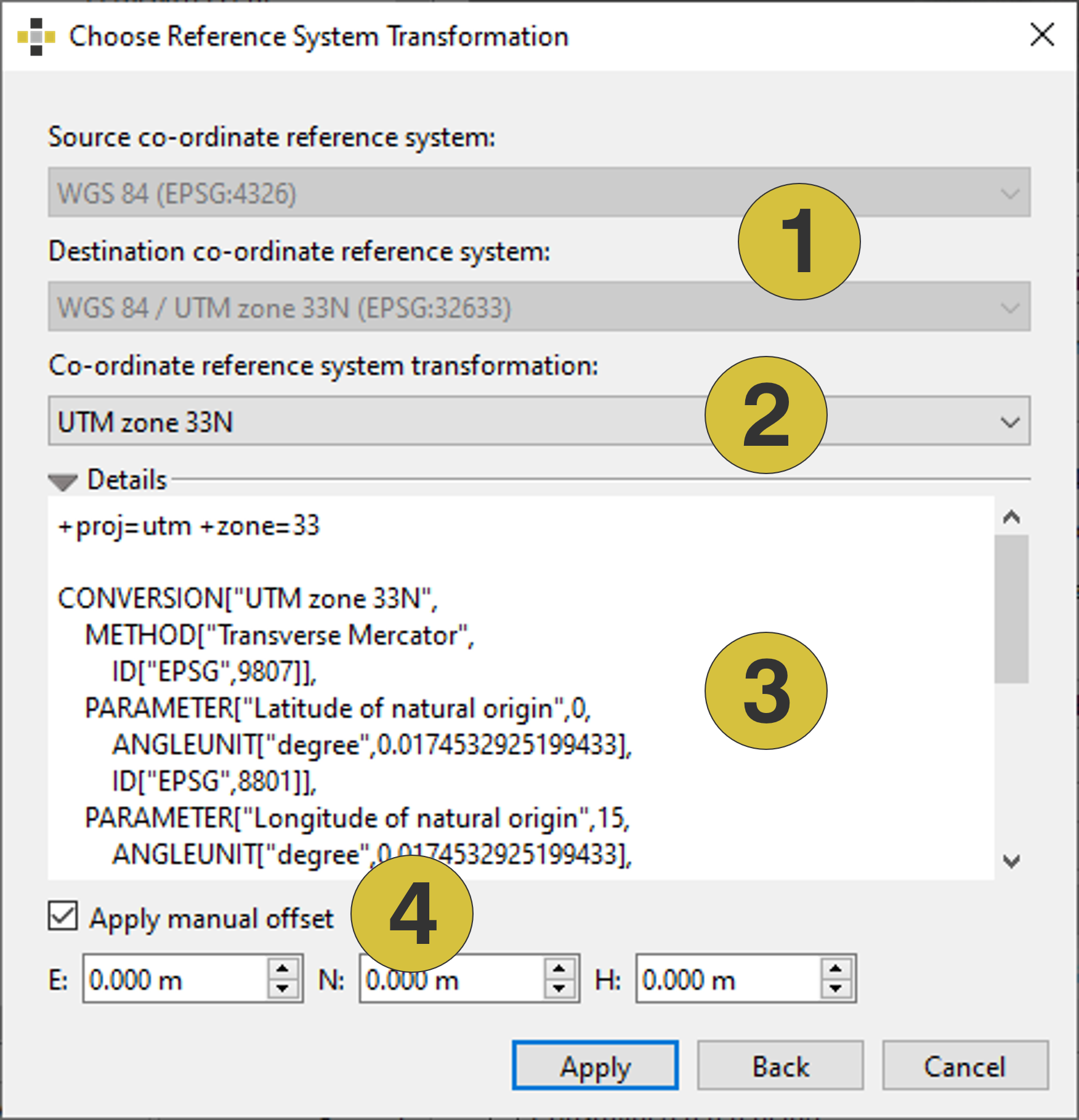
- Destination and Source co-ordinate system
- Transformation
- Transformation details
- Manual offset (optional)