Import Terrain
The Import Terrain  option allows users to generate and import the terrain or landscape of any specified location on the map.
To import a terrain:
- Select File > Import > Import Terrain
- You will see the Import Terrain dialog, which displays a preview of the terrain and allows you to configure the Layer and Region Definition of the selected point on the map using the Select Center on Map button. In addition, you can customize the layer, region dimensions (or area) using the appropriate drop-down menu.
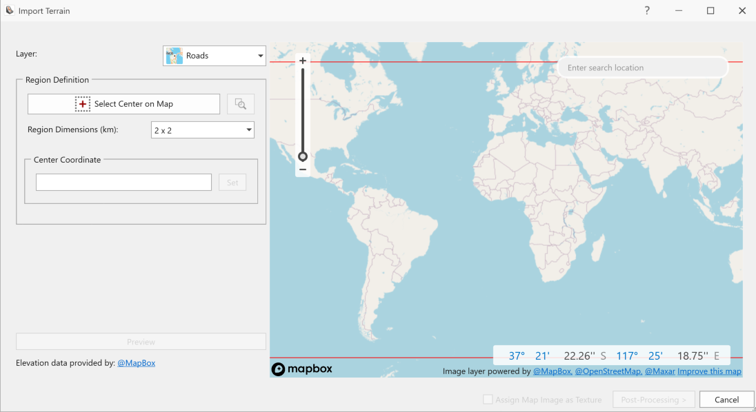
- When the import settings have been configured, check Assign Map Image as Texture and then click on Post Processing.
- You will be navigated the next step of the Import Terrain dialog, given the choices to simplify triangulation & simplify and repair geometry.
The map and satellite images provided in the Terrain Generator come from a third-party tool (Mapbox). The images are not date stamped, though they are generally between 6-18 months out. The map resolution depends on location and availability of satellite data. In some areas, the resolution can be 1 km x 1 km. Elevation data is encoded using each color channel as a position in a base-256 numbering system. This means elevations are mapped to 0.1 m increments.