Import Tre Altamira data
Introduction
This feature let users import the measurement live radar data for ground and structural movement provided by Tre Altamira. The import procedure includes File Loading, Data Type/Property Selection, and Data Filtering and Geometry Preview.
Procedures to Import Data File
FILE LOADING
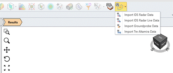
Users can find the Tre Altamira Data Import option in the following places:
- File > Import > Import Tre Altamira Data,
- Interpret > Import Tre Altamira Data, and
- Results > Import Point Cloud Data > Import Tre Altamira Data
After the user selects to import Tre Altamira Radar Data, it opens an Open File dialog. This File Open dialog only accepts shapefiles in the *.shp extension and filters other files. Shapefile is the data format that Tre Altamira uses to save their radar data. Besides *.shp files, Tre Altamira radar data should have other files (including *.shx, *.dbf, *.sbx, *.sbn, *.prj, and *.cpg) to complete the import process. The name of these files must be the same.
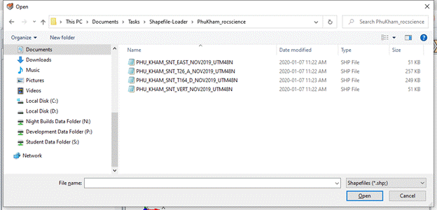
When a shapefile is selected, it starts to import the coordinates from the *.shp file and other information from the *.dbf file. The import process will abort if the *.dbf file is not found in the same directory and pops up a message box with error information. After the data in the files are loaded, it opens a window for data/property type selection.
DATA TYPE/PROPERTY SELECTION
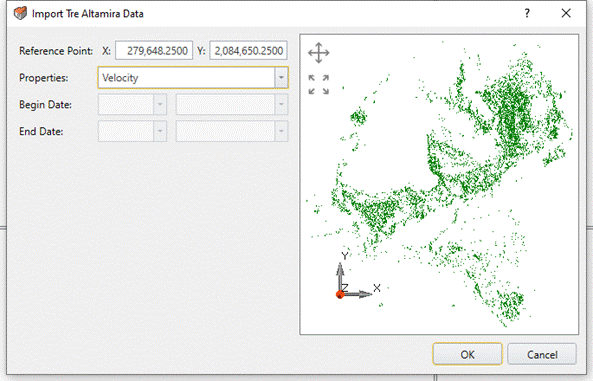
The Data Type/Property Selection Window will show users the available data types/properties and a view of the imported coordinates in a point cloud.
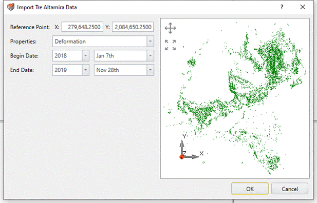
By default, the coordinates in Tre Altamira radar data are in WGS84 (x: longitude, y: latitude), but in some files they are projected in UTM or local grid. For convenience, the coordinates are converted into UTM coordinate system.
On the right side is a viewport that displays the coordinates in a point cloud. The viewport allows users to adjust the view by:
- clicking on the “Pan” button
- moving the mouse with the left button pressed
- zooming in and out by scrolling the mouse wheel.
Users can go back to the default view by clicking the “Zoom Fit” button. It also enables users to select the reference point on the point cloud in the view by clicking the mouse’s left button.
Data Type/Property selection section is on the left side. Reference Point is used as the Origin for Geometry Building. Users can set the reference point by either entering the values in the text boxes or clicking on the point cloud in the viewport on the right.
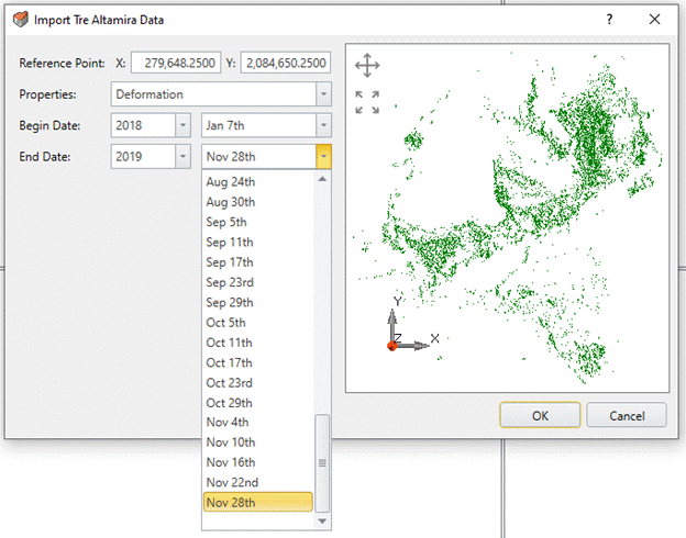
In Properties, it displays all the available properties including Deformation (by data captured date), Velocity (and Velocity in Eastward or Vertical) and Acceleration. Deformation is the default data type if it exists in the shapefile. The Begin/End Dates fields are only active when the Deformation data type is selected, otherwise the section will be disabled and greyed out.
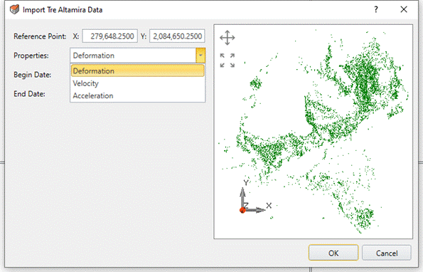
Begin/End Date lists the dates when ground or structural movement is measured. The dates are grouped by years. The measured data on End Date will be imported as radar map values.
After a data type is chosen, select OK to continue.
DATA FILTERING AND GEOMETRY PREVIEW
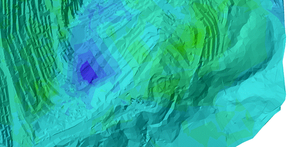
After selecting OK, the rest of the procedures will be the same as Surface Construction in section Import IDS Radar Data.
RESULTS
In the Properties pane, users have the option to View Mesh as either a Points Drawing or a Soild Drawing.