RSLog Advances Quality Management and Geological Interpretation with Latest Features
- Alireza Afkhami, Senior Director of Web Applications at Rocscience
From the first field sample to the final log review, efficiency in borehole data management depends on how seamlessly teams can move from data entry to quality assurance. The latest RSLog update pushes that workflow further — introducing smarter tools for data consistency, visualization, and quality control across every stage of the investigation process.
Quality Management for a Smarter Workflow
The new Quality Management system in RSLog introduces structured oversight for every stage of your subsurface investigation — from field data entry to final approval. Within each project, offices and users can now be assigned specific Quality Management roles that reflect their real-world responsibilities:
- Field Logger – enters borehole data and notifies reviewers when ready.
- Digital Logger – enters borehole data and notifies reviewers when ready.
- Reviewer – verifies logs, resolves comments, and ensures corrections are made.
- Approver – gives final approval and can provide last-stage comments.
- Contract Administrator – oversees project setup and permissions.
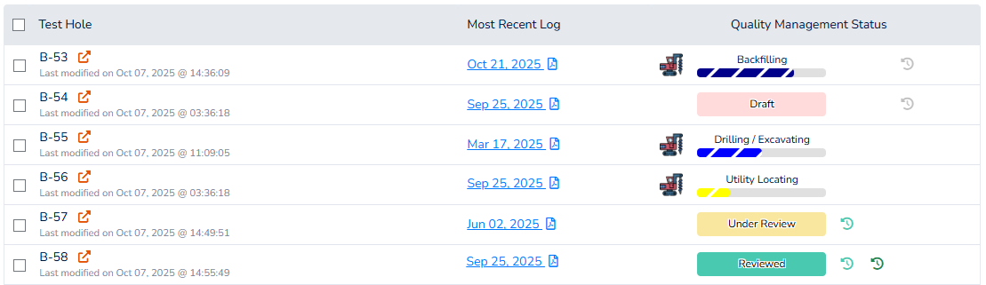
In addition, each borehole now carries a Quality Management Status badge — instantly showing whether it’s in Draft, Under Review, Reviewed, Approved, or Locked state. These statuses update automatically as the workflow progresses, creating transparency and eliminating version confusion.
This system transforms how teams collaborate on a project. Automatic email notifications alert reviewers and approvers when action is required, and comments are logged directly within RSLog. Once approved, boreholes can be locked to prevent edits, securing your data integrity and supporting auditable QA/QC documentation.
By embedding quality management into the logging process, RSLog bridges the gap between data collection and review process — an essential step for multi-office teams and consultants operating under strict quality assurance standards.
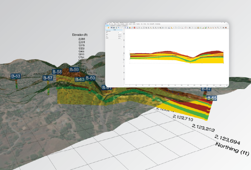
Cross-Section Designer with Geological Formations
The Cross-Section Designer now integrates geological formations directly into your profiles. Engineers can visualize subsurface conditions not only by soil classification but also by formation — a crucial distinction for regional and structural geology assessments.
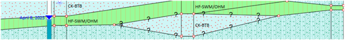
In Profile View, the new Source of Descriptions property allows instant switching between Soil Classification and Geological Formation, giving you flexibility in how subsurface data is represented and interpreted. This enhancement brings RSLog’s visualization closer to geological reality, allowing a more intuitive understanding of the site’s stratigraphy.
Expert Tips
RSLog continues to offer unmatched flexibility in how engineers record and present borehole data. A few tools worth exploring:
- Smarter, Clearer Data with Concatenated Columns:
Presenting test data on borehole logs often requires combining multiple data fields into a compact format. The new Concatenated Columns feature lets you do exactly that — automatically merging multiple test results into a single, cleanly formatted column. - Enhanced SPT Rules and Visualization Control:
RSLog’s SPT Rules tab now gives you granular control over how blow counts are calculated, formatted, and displayed — all in line with ASTM D1586.
Users can define how refusals (REF) and weight of hammer/rod (WH/WR) cases are handled, customize text alignment, and even choose whether blow counts appear at the top, middle, or bottom of the sample on both the log and the graph.
Multiple display modes allow you to (see documentation): - Plot SPT blow counts alongside other field or lab tests, or
- Display SPT results as vertically split values within the same log column.
- Extra Tags: Add new custom fields to expand your dataset and make logs as detailed as your projects demand (see documentation).
This flexibility ensures your logs communicate test data exactly the way your reviewers, clients, or regulatory agencies expect to see it.
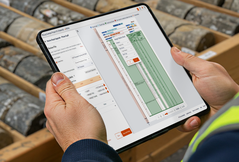
Consistency Through Detailed Stratigraphy Data Entry
For organizations managing multiple projects and personnel, consistency is critical. RSLog’s Detailed View on the Stratigraphy data entry page ensures that all lithologic descriptions are compiled from standardized dropdowns — such as soil and rock properties, weathering levels, and fracture types — eliminating user typos and inconsistencies across organization.
Behind the scenes, RSLog automatically compiles this information using the Layer Description Compiler, guaranteeing that every borehole log across your organization speaks the same technical language.
Summary
RSLog’s latest update strengthens the link between field data, quality management, and final reporting. By unifying how teams plan, log, and review boreholes, it ensures every dataset meets the same standard of precision — across projects, offices, and clients. Whether you are digitizing legacy logs or building new investigations from the ground up, RSLog turns data into dependable insight.