Your Paper Borehole Logs Can Be Digitized in Minutes - Here’s How
Data drives decisions in geotechnical engineering, and historical borehole data typically still lives on paper. Whether inherited from past projects or created in the field by hand, paper borehole logs remain a frustrating bottleneck in many workflows.
Manual entry is time-consuming, error-prone, and rarely the best use of a skilled engineer’s time. That’s why RSLog’s new Optical Character Recognition (OCR) feature was developed — to help geotechnical teams unlock and reuse legacy data without starting from scratch.
This article breaks down why RSLog’s OCR matters, how the tool works, and how you can integrate it into your workflow with minimal effort. If you're still typing borehole data by hand, or avoiding old logs altogether, this tool could save you hours and make your process more efficient.
Why Borehole Logs Are Central to Your Geotechnical Workflow
Whether you're modelling stratigraphy, designing foundations, or producing compliance reports, your project likely begins with a subsurface investigation that generates borehole logs. These documents capture the vertical profile of the subsurface, typically including soil and rock descriptions, SPT results, groundwater conditions, and sampling data.
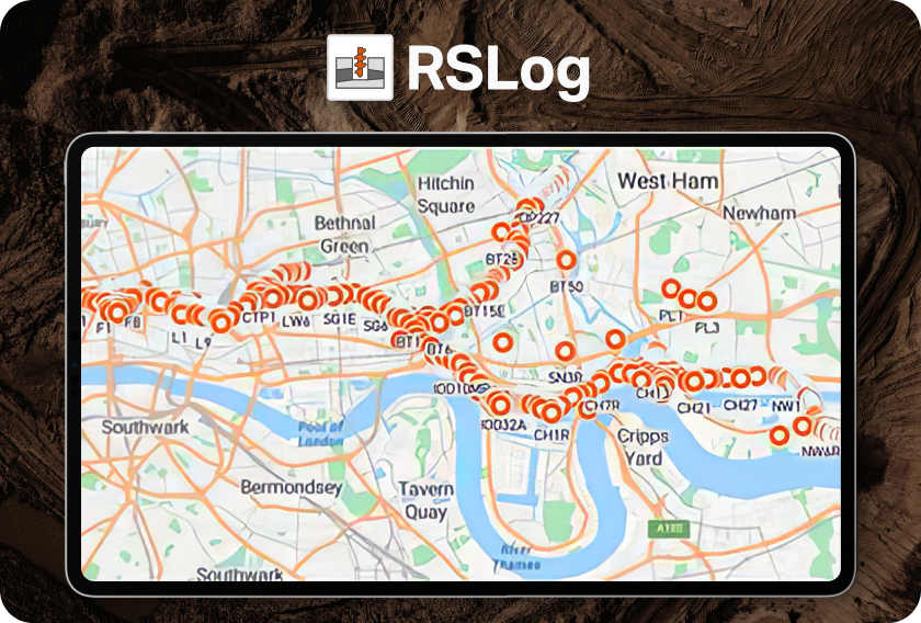
But when those logs exist only as PDFs or scanned field notes, the data can become siloed, static, and hard to reuse. RSLog’s OCR tool solves this by extracting structured data directly from scanned borehole logs, enabling immediate use across the platform. With digitized logs, you can move seamlessly into cross-section design, GIS mapping, and report generation, without ever retyping the data.
Tip: Standardizing your borehole logs through OCR ensures consistent data structure across projects and reduces the risk of errors during analysis and reporting.
How to Digitize a Borehole Log with RSLog OCR
Digitizing a borehole log with RSLog begins by uploading your scanned PDF into the OCR module. The tool then guides you through creating or applying a page template that identifies key data sections — depth intervals, field test columns, sample data, and descriptive fields. AI-powered extraction recognizes most standard fields, and the user interface allows manual corrections when needed. Once the template is confirmed and data is validated, RSLog imports the log into a structured, editable digital format. This process significantly reduces the manual overhead required for legacy data entry.
Tip: RSLog's template-matching system allows you to process multiple borehole logs efficiently, especially if they follow the same format.
What Can You Do With a Digitized Borehole Log?
Once your borehole log is digitized, it becomes a live data object within RSLog, enabling automated cross-section generation, integration with GIS mapping tools, and direct export to formats used in other geotechnical or BIM software. Each entry is searchable, linkable, and can be edited or validated throughout the project lifecycle. This enables faster collaboration across disciplines and makes it easier to respond to design changes or regulatory requests. RSLog also keeps your scanned source files accessible in the cloud for reference or audit purposes.
Tip: Digitizing historical boreholes makes your valuable historical projects centralized, searchable, and always accessible from the cloud.
Tips for a Smoother Borehole Log Digitization Process
Although the initial setup requires some hands-on verification, once you’ve built a strong template, that same structure can be reused across hundreds or thousands of borehole logs in future projects. These tips will help you create clean templates and avoid common issues.
- Start with clean scans: High-resolution, legible scans improve AI detection and reduce time spent correcting template guesses.
- Create flexible templates: One well-built template can be reused across dozens of logs with similar formats, saving hours of work.
- Use the hover and highlight tools: The sidebar and PDF viewer work together to help you quickly find and verify each data point.
- Manually add critical fields: If the AI misses something important like a project note or SPT value, use “Add Data” to define it yourself.
- Watch for overlapping fields: When a word is selected for multiple categories (e.g., both start and end date), double-check for accuracy.
How to Maintain Accuracy When Using RSLog OCR
RSLog's AI engine handles most of the heavy lifting, and these tips will help you make quick corrections to ensure that your historical borehole data is complete, reliable, and ready for analysis.
- Confirm every section header and data label: Especially in areas with smudges or unusual formatting, column headings or labels could be assigned incorrectly.
- Use “Shift+A” to unassign incorrect values: This keyboard shortcut helps clean up messy data faster when labels are mismatched or repeated.
- Review coordinates carefully: Ensure that signs (positive/negative) are captured correctly, especially for latitude, longitude and elevation data.
- Customize your template for project context: You can set the unit system and coordinate reference system when creating new logs to match site requirements.
- Check stratigraphy layers post-import: Make sure lithologic descriptions and depth intervals are properly extracted and aligned for accurate reporting.
Digital Documents Build Better Workflows
Paper logs are still part of many geotechnical workflows, and RSLog’s OCR tool provides a clear path toward digitization historical borehole logs without overhauling your entire process. By converting data into structured digital formats, you can streamline project workflows, reduce errors, and make your data easier to access and apply going forward.
Ready to bring all your paper borehole logs to the cloud?
Start your free trial of RSLog and get 50 free OCR credits today!
Free Trial