The Critical Value of Field Documentation and Lab Reconciliation in Geotechnical Site Investigation
- Alireza Afkhami, Senior Director of Web Applications at Rocscience
Subsurface characterization in geotechnical engineering relies on a critical data pipeline that stretches from the initial site investigation to final laboratory evaluation. Because subsurface conditions are inherently variable and physical samples can degrade upon extraction, accurate field documentation provides a critical baseline for project safety, design precision, and risk management.
This article examines the technical and legal value of field data collection during subsurface investigations, focusing specifically on the systematic use of field notes, photographic records, and the subsequent reconciliation of visual-manual classifications with quantitative laboratory test results. Field documentation is not merely an administrative exercise. It is a rigorous engineering process that captures perishable physical metrics, reduces human subjectivity, identifies sampling anomalies, and mitigates legal liabilities.
Ultimately, the integration of qualitative field observations and quantitative laboratory data provides the foundation for building dependable 3D subsurface models and supporting the structural integrity of civil infrastructure.
1. Field Data Collection
The primary challenge of subsurface investigation is that the very act of extracting a soil or rock sample alters its physical state. The moment a sample is removed from its in-situ stress state via drilling, augering, or split-spoon sampling, it begins to degrade.
Soil moisture content, macro-structural features, and shear strength are highly perishable metrics. An unpreserved sample of fine-grained soil will rapidly lose moisture, changing its consistency from soft to stiff, which can profoundly distort subsequent evaluations. Field documentation acts as the only permanent record of these properties in their freshest possible state.
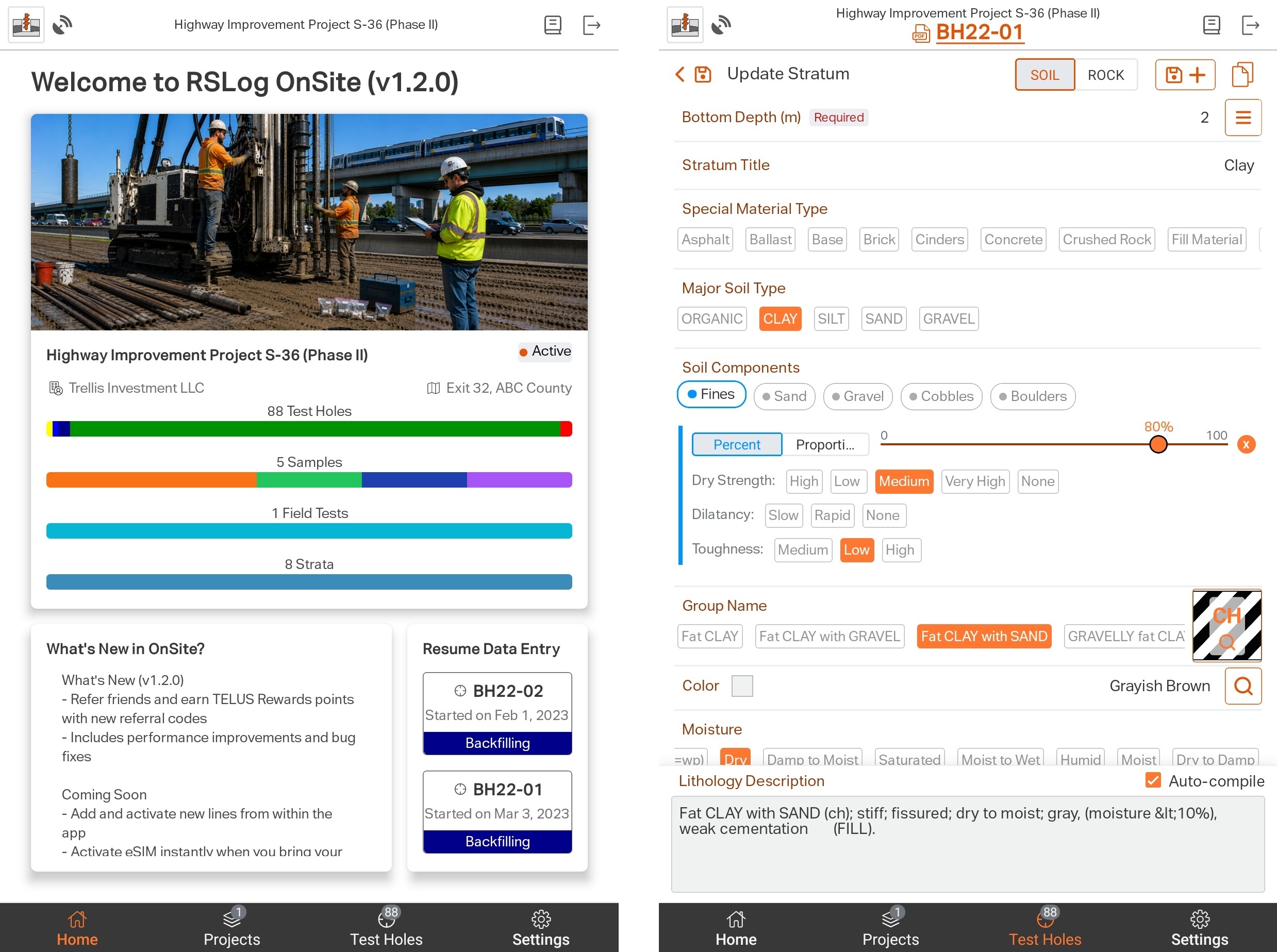
Use the RSLog OnSite app (iOS and Android) for streamlined field data collection. It provides real-time sharing of field data and site investigation progress with engineers in the office.
1.1 Capturing Transient Environmental Variables
Subsurface conditions are heavily influenced by the immediate surface environment. Standard logging practices under ASTM D5434 require the recording of transient field variables, including:
- Daily weather fluctuations and temperature extremes
- Heavy precipitation events prior to or during drilling operations
- Surface water runoff patterns across the project site
Without these documented contexts, an abnormally high water content reading in a subsequent laboratory test might be misconstrued as a permanent site hazard rather than a temporary anomaly caused by a flash rain event that saturated the borehole collar during drilling.
1.2 The Value of Non-Physical Indicators
A laboratory technician looking at a jar of remoulded sand cannot discern how difficult it was to extract. It is the responsibility of the field engineer to record:
- Drilling Rig Behaviour: Heavy rig chatter, torque spikes, or smooth drilling feed.
- Fluid Dynamics: Sudden loss of drilling fluid circulation, which strongly signals the presence of highly permeable gravel zones, open joints, or subterranean voids.
- Refusal Depths: The exact depth of auger or casing refusal, indicating a transition into unweathered bedrock or massive boulders.
1.3 Photographic Documentation
ASTM D2488 provides a robust framework for the visual-manual description of soils, guiding the field logger to estimate attributes such as plasticity, dry strength, and toughness using simple manual manipulation. Even with these criteria, human perception varies.
While written descriptions are vital, language is inherently subjective. Two engineers with varying levels of experience might describe the same soil sample using slightly different terminology. Digital photography provides an objective, immutable counterweight to this human bias.
Beyond engineering characterization, photographs serve a vital administrative role. Labels on physical sample bags can get torn, smudged by mud, or degraded by condensation. A complete photographic archive of the sampling process allows project managers to resolve data-entry typos, track down missing samples, and confirm the chain of custody between the drill rig and the laboratory storage locker.
With the new photo management feature in RSLog, assign photos to each data entity (sample, run, field test, etc.) and include photos in the log. Generating a photo report by filtering and sorting photos, for example by borehole name or tag, could not be easier.
1.4 Structural Integrity and Scale in Rock Mass Characterization
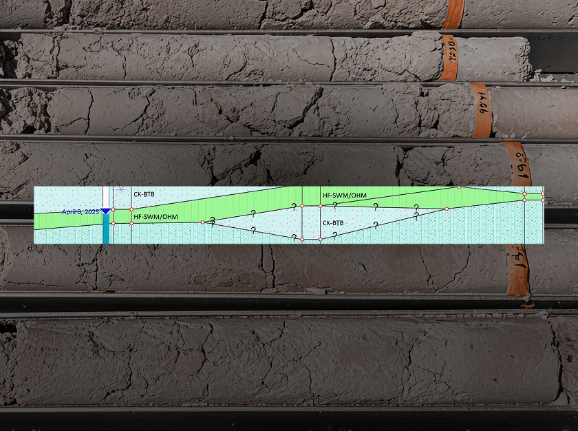
In rock coring operations, photography is an absolute technical requirement rather than an option. The structural behaviour of a rock mass is dictated primarily by its discontinuities, such as fractures, bedding planes, and shear zones, rather than the intact strength of the rock material itself. Field photography must capture these features immediately as the core barrel is opened. To hold technical value, these photographs must include:
- Spatial Identifiers: Clear labelling of the borehole number, core box number, and exact depth intervals.
- Scale Bars: Engineering scales placed parallel to the core to allow accurate, retroactive measurements of fracture spacing.
- Colour Calibration Strips: Standardized colour cards to correct for changing sunlight or artificial lighting conditions, ensuring true geologic colour replication.
2. Data Reconciliation: Comparing Field Logs with Laboratory Test Results
The ultimate synthesis of a geotechnical investigation occurs during data reconciliation. This is the process where qualitative field descriptions are systematically mapped alongside quantitative laboratory index data.
RSLog has a built-in feature to show the field notes side-by-side with the latest borehole log. This helps identify the missing links between field and laboratory data.
2.1 The Intersection of ASTM D2488 and ASTM D2487
In American and international practice, a distinct boundary separates field identification from laboratory classification. Field logs rely on ASTM D2488 (visual-manual), while laboratory engineering classifications rely strictly on ASTM D2487 (Unified Soil Classification System, or USCS).
The USCS classification is purely mathematical, derived from sieve analyses (grain-size distribution) and Atterberg limits (liquid limit and plasticity index). True data reconciliation requires stacking these two datasets side-by-side to identify where human field estimates match or diverge from physical laboratory realities.
When field notes and laboratory data diverge, they highlight a potential flaw in the project data pipeline. For example, if a field engineer logs a sample as "stiff, low-plasticity silt" based on pocket penetrometer testing, but the subsequent laboratory unconfined compression test reveals a soil with virtually zero shear strength, a data anomaly is flagged. By referencing the field notes and photographs, the project engineer can determine the root cause:
- Did the sample experience significant vibration and disturbance during transport?
- Did the sample dry out significantly because of poor wax-sealing of the tube?
- Was there a clerical mix-up where sample labels from two different depths were swapped?
Without comprehensive field notes detailing the sample handling and initial state, such anomalies are often ignored, leading to the dangerous inclusion of erroneous test data in design calculations.
2.2 Updating the Final Boring Profile
The final product of a site investigation is the formalized boring log. A frequent mistake in industry workflows is completely erasing the original field impressions and overwriting them with laboratory results. Best practices dictate that the final profile must preserve both datasets. The qualitative field observations provide the spatial continuity of the ground strata, while the laboratory test points anchor those descriptions with numerical precision. Retaining the history of this evolution ensures that any engineer reviewing the log can assess the level of data reliability across the entire depth of the borehole.
2.3 Enforcing a Quality Management System
A robust Quality Management System (QMS) is essential for ensuring the accuracy, consistency, and traceability of geotechnical field and laboratory data throughout a project. Standardized digital workflows help enforce established procedures for collecting, validating, and reviewing borehole logs, sampling records, in-situ test results, and laboratory test data. Built-in validation rules, mandatory fields, controlled terminology, and automated quality checks reduce transcription errors, improve data completeness, and ensure compliance with industry standards and project specifications.
Review and approval workflows provide accountability by documenting revisions, tracking changes, and maintaining a complete audit trail from data acquisition to final reporting. By integrating quality management into every stage of the data lifecycle, geotechnical organizations can improve confidence in their data, streamline project delivery, and produce more reliable engineering analyses and decisions.
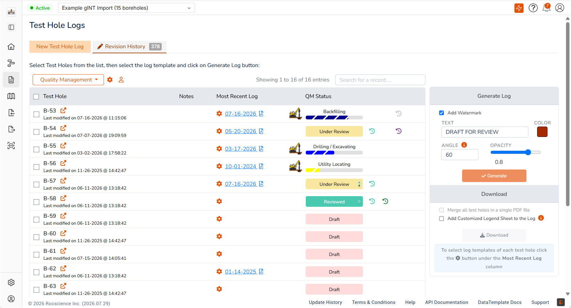
RSLog has a built-in quality management system that allows you to assign review and approval roles to each borehole. Check the QM status of each borehole at any point, view the details of review comments and marked-up logs, and even lock the borehole data.
3. Enabling Accurate 3D Geotechnical Modeling
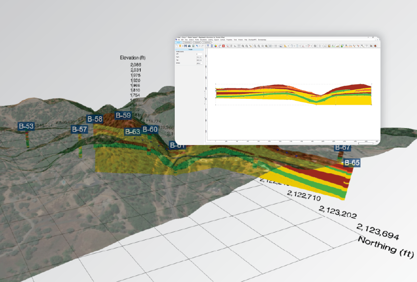
Modern infrastructure projects increasingly rely on Building Information Modeling (BIM) and 3D subsurface software to interpolate soil layers across a site. These digital models require clean, standardized inputs. If field data logging is chaotic or inconsistent, the model will generate erratic or incorrect geologic surfaces, a classic manifestation of the "garbage in, garbage out" principle. Meticulous documentation guarantees that the digital model mirrors the true physical boundaries of the subsurface.
RSLog’s Cross-Section Designer is the right tool for creating 2D and 3D subsurface models, with the ability to export your design to CAD, GIS, and CSV formats.
4. Conclusion
Field documentation in geotechnical engineering is far more than a secondary administrative task. It preserves critical information that can be lost as samples move from the field to the laboratory, provides an objective visual record of subsurface conditions, and creates the traceability needed to reconcile field observations with laboratory results.
High-resolution, standard-compliant photography provides an objective visual baseline that reduces human subjectivity and secures data continuity. The deliberate reconciliation of field logs with laboratory index testing then creates a validated, error-checked dataset capable of supporting sophisticated 3D engineering models.
RSLog’s latest update strengthens the link between field data, quality management, and final reporting. By unifying how teams plan, log, review, and manage boreholes, RSLog helps ensure that every dataset meets a consistent standard of precision across projects, offices, and clients.
Build a Better Geotechnical Data Workflow
Explore RSLog’s tools for field data collection, borehole management, quality control, and reporting, all designed to keep your geotechnical data connected.
Start Your Free Trial