A Critical Discontinuity Revealed, 60% Less Exposure: Ferbasa's ShapeMetriX Workflow
- Yalin Dogan, Geotechnical Product Manager at Rocscience
When Access and Geological Conditions Limit What You Can Measure
In underground excavations, obtaining reliable structural measurements can be difficult even when discontinuities are critical to stability assessment. At Ipueira Mine in Bahia, Brazil, early application of shotcrete restricted access to natural excavation faces, while magnetite in the host rocks interfered with geological compass readings. These conditions limited both the number and reliability of measurements technicians could collect using conventional field methods.
To address these challenges, the Ferbasa geotechnical team evaluated smartphone-based photogrammetry using ShapeMetriX. The approach enabled technicians to reconstruct excavation faces as 3D models and characterize discontinuities digitally, reducing their reliance on direct measurements at active excavation fronts.
The comparison with conventional field mapping revealed a particularly important finding: photogrammetry identified a subhorizontal discontinuity family with an average dip of approximately 7°, compared with 33° recorded through field mapping. The team also reported an approximately 60% reduction in technicians' activity time at excavation faces.
Site Conditions and Mapping Challenges
The Ipueira Mine is situated within the Jacurici Complex of the São Francisco Craton in Bahia, Brazil. The deposit hosts significant chromite mineralization within a mafic-ultramafic sequence approximately 300 m thick, comprising gabbros, harzburgites and dunites. Chromite-bearing horizons occur within generally serpentinized harzburgites.
Reliable discontinuity characterization is therefore important for understanding ground conditions, refining geological models and supporting excavation and mine planning.
However, conventional mapping at Ipueira faced four principal limitations:
- Restricted access: Immediate shotcrete application following excavation prevented safe direct measurements of natural rock faces.
- Magnetic interference: Magnetite-bearing rocks affected geological compass readings, potentially introducing systematic errors into orientation measurements.
- Limited sampling: Reduced access constrained the number of observations, increasing the potential for statistical bias in discontinuity characterization.
- Accuracy in structural georeferencing: the discontinuities cannot be surveyed to represent the real location on the excavation.
These constraints motivated the evaluation of photogrammetry as a way to collect structural information from images rather than relying exclusively on direct measurements at the excavation face.
The Approach: Photogrammetry Workflow
The team implemented a photogrammetry workflow using readily available equipment: a Motorola Moto G32 smartphone, two 6,000-lumen flashlights and a desktop workstation with an Intel Xeon processor and 32 GB of RAM.
Technicians captured approximately 45 photographs of each excavation face, maintaining around 70% overlap between images. Photographs were taken from distances of approximately 8 to 12 m, with coverage extending across the sides, front and roof of the excavation.
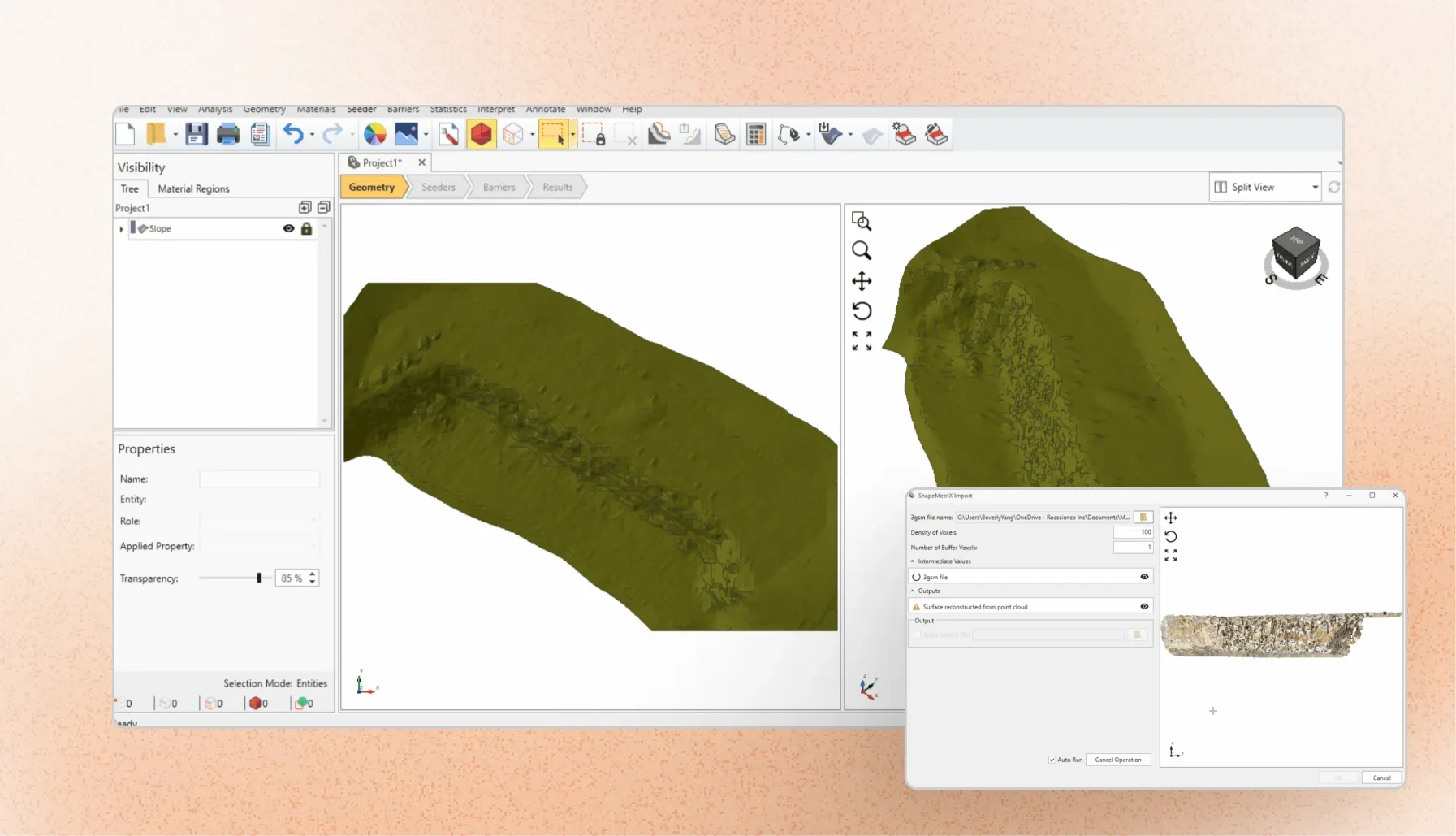
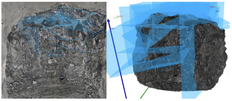
The images were imported into ShapeMetriX and processed into high-resolution 3D point clouds representing the excavation geometry. These digital models provided the basis for identifying and measuring discontinuity orientations without relying exclusively on compass readings taken underground.
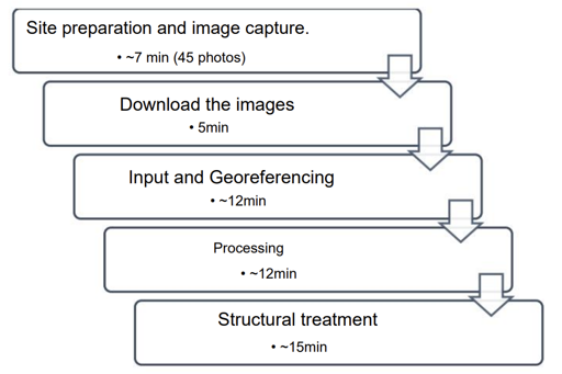
For the reported application, the complete workflow took approximately 51 minutes. Image capture accounted for approximately seven minutes of this process.
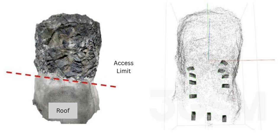
The team also used GEM4D to create control points for georeferencing, reducing dependence on conventional topographic surveys for this step. Reported georeferencing deviations were on the order of centimetres and did not compromise the intended structural survey. The team also demonstrated the ability to process up to three models simultaneously.
Results: Structural Mapping and Operational Benefits
Improved Discontinuity Characterization
The value of the workflow became particularly clear when the team compared structural data obtained through photogrammetry with conventional field mapping.
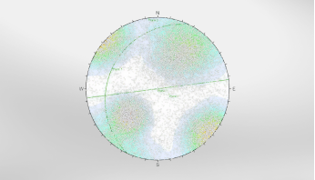
The stereographic comparisons showed a substantially larger population of discontinuities identified through photogrammetry. This provided a more representative dataset for characterizing structural families and reduced the probabilistic uncertainty associated with limited field sampling.
Most notably, photogrammetry identified a subhorizontal discontinuity family, designated Set 2, with an average dip of approximately 7°. Field mapping had recorded a corresponding family with an average dip of approximately 33°. The authors suggest that possible explanations for this difference include manual reading errors, apparent-dip measurements or incomplete representation of the structures during field mapping.
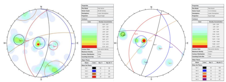
Figure 4. Comparison of structural mapping results obtained through photogrammetry (left) and conventional field mapping (right). This difference has direct geomechanical significance. Subhorizontal discontinuities can act as release surfaces for blocks in excavation roofs. If their orientation or presence is not adequately characterized, their potential contribution to block detachment may also be underrepresented in stability assessments and support design.
Recognizing the prominence of this discontinuity family, the Ferbasa geotechnical team extended its investigation to other excavations beyond those included in the initial study. The team reported finding the structure across the deposit.
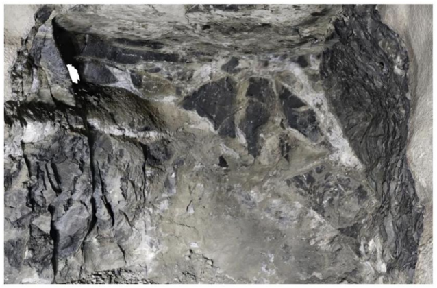
Figure 5. Subhorizontal discontinuity observed in an excavation roof at Ipueira Mine. Refining Geological Interpretation
Beyond structural characterization, the photogrammetric models helped refine the interpretation of geological contacts and faults controlling the displacement of the mineralized body.
At Ipueira, the distinction between chromitite and the surrounding harzburgite was supported by visual characteristics captured in the models. The chromitite's metallic to submetallic lustre, together with its characteristic brown streak in areas exposed during scaling, helped the team distinguish lithological contacts.
These observations provided additional geometric information for updating the short-term lithological model. They also offered a means of checking geological contacts against exploration data, where deviations in rotary-percussive borehole trajectories can introduce uncertainty into the interpreted position of mineralization.
For mine planning, better-defined contact geometry can support reserve estimation and stope design. The authors identify reduced dilution and ore loss as potential operational benefits of improving this information; however, the study does not quantify reductions in either.
Reducing Time at Active Excavation Faces
The workflow also changed where and how structural mapping could be completed. By reducing the need for extended manual compass measurements and field sketching, photogrammetry allowed technicians to perform much of the data collection through image capture, with subsequent model processing and structural treatment carried out away from the excavation face.
Ferbasa reported an approximately 60% reduction in technicians' activity time at excavation faces. This reduced the time personnel needed to spend at these locations while allowing subsequent activities in the excavation cycle to proceed sooner.
The approach was not without implementation challenges. Image quality was sensitive to underground lighting and suspended dust or mist, which could introduce noise into the point cloud and require additional processing or image recapture. Insufficient image overlap and shadows caused by flashlight positioning also affected model quality during the initial implementation.
As implementation expanded, the team also recognized the need to balance survey frequency with available processing capacity, particularly as the volume of models requiring structural treatment increased. Consistent image-capture practices and a manageable processing schedule were therefore important to maintaining model quality and supporting wider adoption.
Building a More Representative Geomechanical Dataset
The Ipueira Mine case study demonstrates how photogrammetry-based workflow using ShapeMetriX can improve the quality and representativeness of structural mapping in underground excavations.
By reconstructing excavation surfaces as 3D models, Ferbasa's technical team reduced dependence on direct field measurements affected by access restrictions and magnetic interference. The workflow produced a larger discontinuity dataset, supported geological model refinement and reduced technicians' time at active excavation faces by approximately 60%.
Most significantly, the digital mapping identified a subhorizontal discontinuity family with an average dip of 7°, compared with 33° recorded through conventional field mapping. This finding prompted further investigation across the deposit and highlighted a structural feature relevant to roof stability and excavation support design.
Currently, Ferbasa applies this workflow to 100% of its development excavations and maintains a database containing over 5,000 mapped structures.
This database of structures assists engineers with specific rock mass support tasks, as well as with geotechnical risk management during stope mining – a process in which risk analyses have been enhanced by the inclusion of georeferenced structural data.
For underground mining engineers, the value of this approach extends beyond faster data acquisition. More complete and representative structural information provides a stronger basis for geological interpretation, geomechanical characterization and excavation planning.
Improve Underground Structural Mapping with ShapeMetriX
Capture 3D excavation models from standard photography to characterize discontinuities, reduce exposure at active faces, and build a more representative geomechanical dataset.
Start Your Free Trial