RSLog & Geosetta Integration: Easier Access to Historical Subsurface Data
Subsurface exploration is a fundamental phase of all geotechnical projects. Although subsurface data is critical for engineering analysis and design, it comes at a substantial cost to owners. For many years, geotechnical consultants have attempted, with varied success, to convince stakeholders that collecting additional subsurface data pays for itself by reducing construction claims and change orders.
One engineering resource that often goes overlooked and underutilized is geotechnical data from prior investigations. Although most drilling data collected through public projects is legally accessible to the public through a freedom of information request, most local, state, and federal agencies do not have the capacity to digitize, organize, and manage their geotechnical data in a central database. As a result, engineers are often unable to access this historical borehole data, and sites are re-drilled at additional expense.
Geosetta is a non-profit organization with the goal of aggregating all publicly available geotechnical datasets into a single easy-to-use database which allows students, consultants, owners, and regulators alike to access this data. This bypasses the paperwork typically needed to unearth valuable historical data, and instead, allows engineers to focus on data interpretation. The borehole data stored in Geosetta’s database can be downloaded in DIGGS format and processed prior to use by engineers.
Efficient Access to Historical Borehole Data
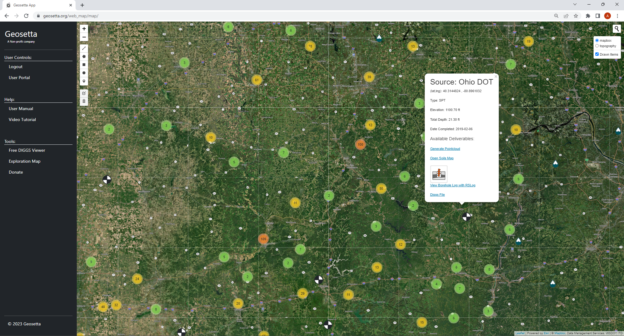
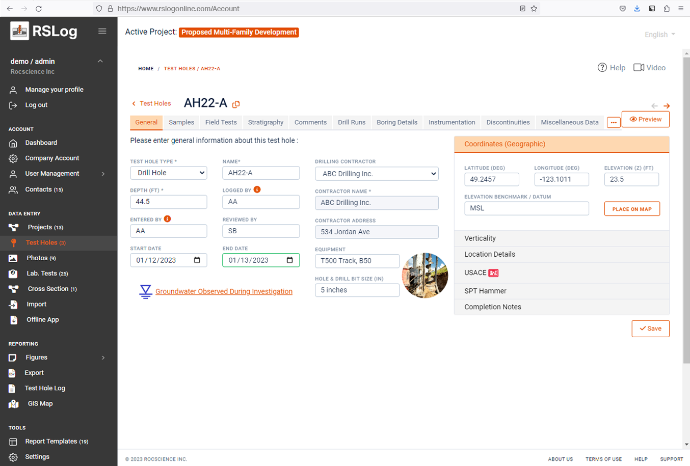
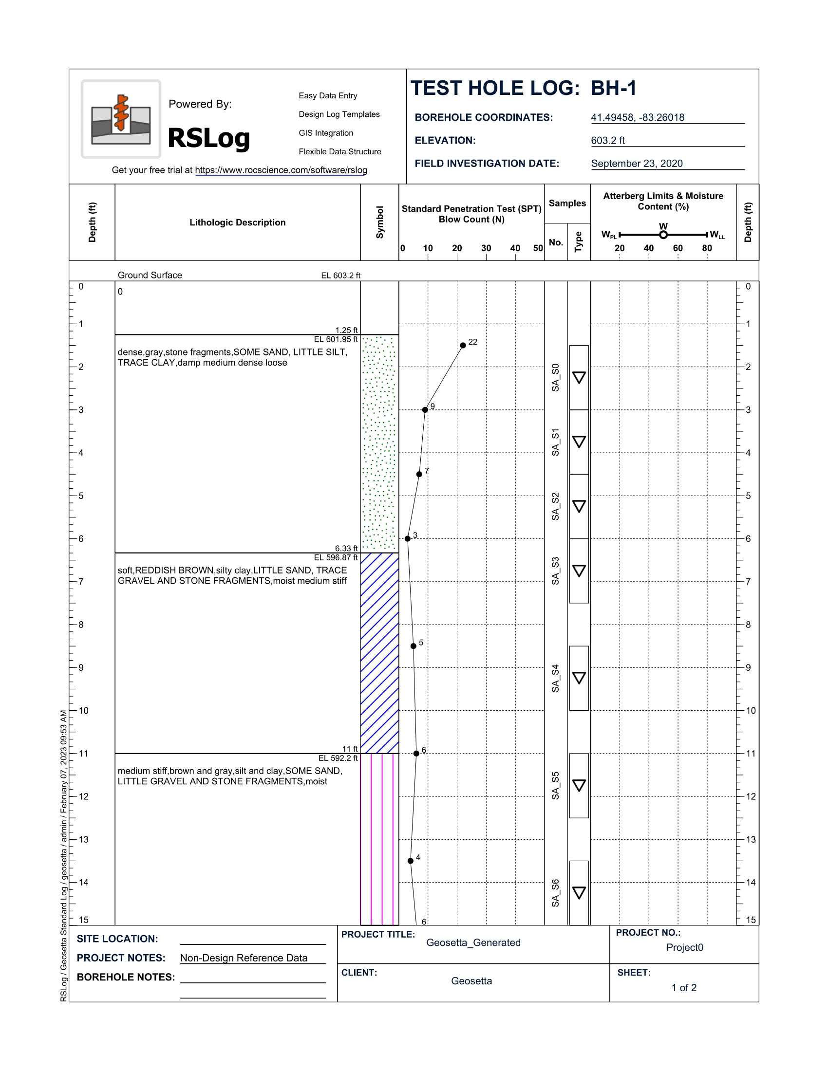
In late 2022, we partnered with Geosetta to offer a borehole log viewer for the historical boreholes. Once a borehole is selected on Geosetta’s website, the borehole data is processed using our cloud-based borehole data management software RSLog, and a borehole log is automatically generated in PDF format. Depending on the data available in a borehole, lithologic descriptions, graphic hatch patterns, samples, SPT blow counts, moisture content, and Atterberg limits test results are presented in the borehole log. This provides quick access to the most valuable subsurface data for each borehole.
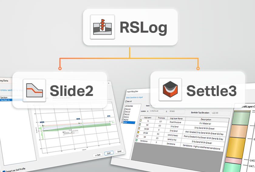
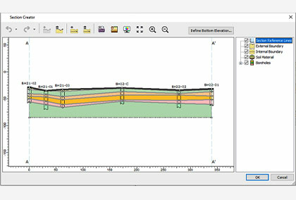
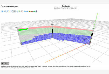
With RSLog, you can access your borehole data at any time, by simply logging in to the website. It covers variety of drilling methods, sample types and field tests, and offers a flexible log template designer so you can prepare borehole logs that match your company’s style and standards. Using the cross-section designer, you can create a 3D visualization of your project’s boreholes and cross sections, importing a terrain model, and more with no need for additional data entry.
Want to migrate your projects to RSLog?
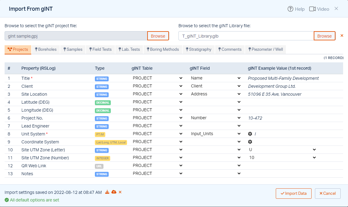
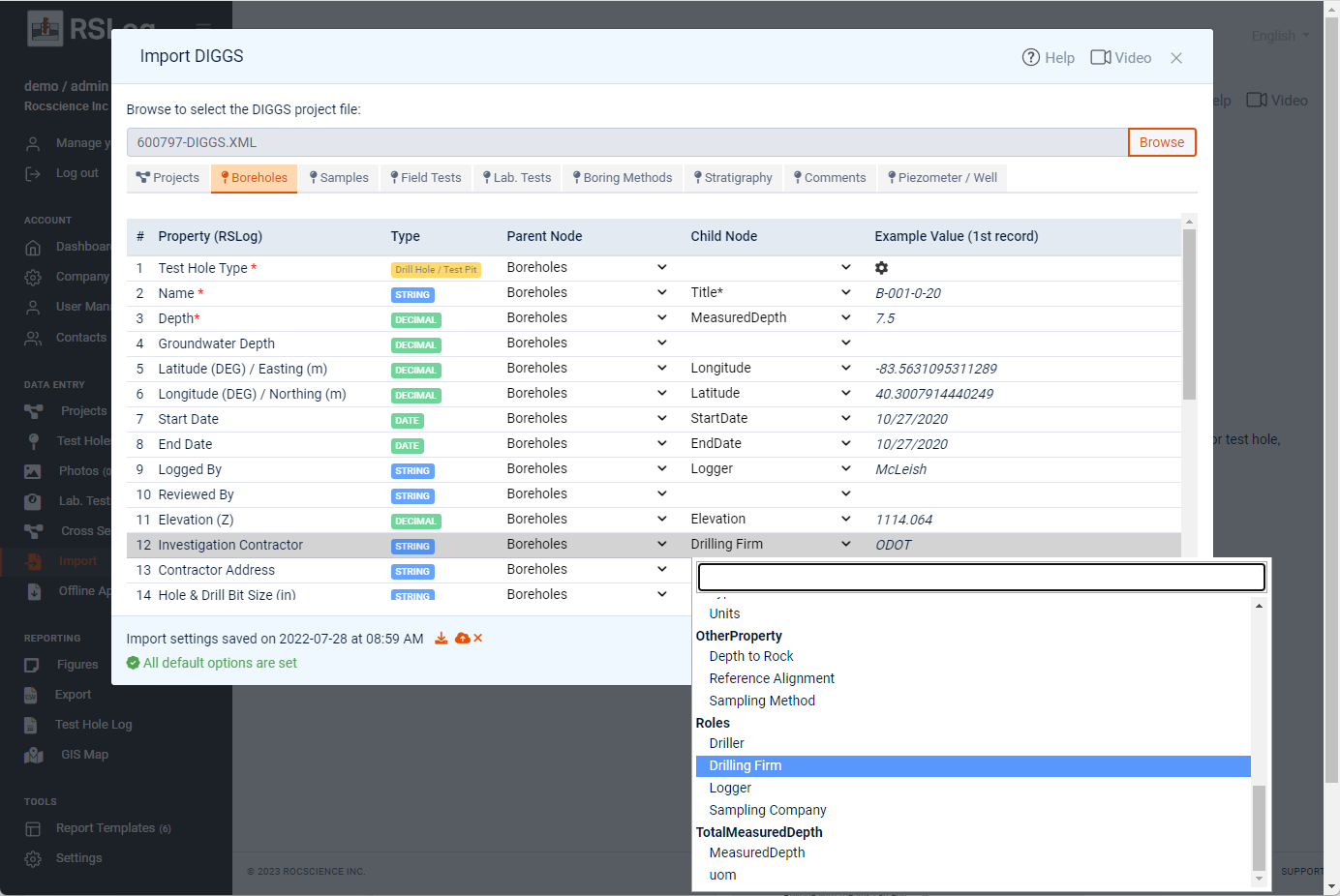
If you have projects in gINT or DIGGS formats, RSLog can import this borehole data at no additional cost. Your previous projects along with projects created in RSLog will all be included in a built-in GIS map.
If you would
like to switch to RSLog but are
concerned about your previous projects’
borehole data,
we can offer
consultation services to help ensure your data migration to RSLog is a smooth
process.
More from Rocscience