From Split Workflows to Single Solution: Fincha Sugar Factory Road Rock Slope Analysis with RocSlope2
What happens when adversely fractured rock, and seasonal rainfall converge on a steep mountain road? In Ethiopia’s Oromia region, this dangerous mix triggered recurring slope failures that cut off access to the Fincha sugar factory, threatening safety, infrastructure, and economic stability.
Slope instability in mountainous terrain is a global engineering challenge. Steep topography, weather extremes, and fractured rock masses all increase the risk of landslides and rockfalls. These hazards can disrupt transport corridors, compromise public safety, and derail entire infrastructure projects.
On the road to Fincha, engineers relied on Swedge and RocPlane, alongside detailed field and lab investigations, to assess failure modes and design site-specific remediation. In this case study, we revisited the same slope conditions using RocSlope2 – a unified tool that combines the capabilities of both – and successfully replicated and validated the original outcomes.
The result is a clear example of how data-driven design, paired with modern analysis tools, can turn high-risk terrain into safer, more resilient infrastructure. It’s a model with broader relevance for projects facing similarly complex geological challenges.
The Challenge
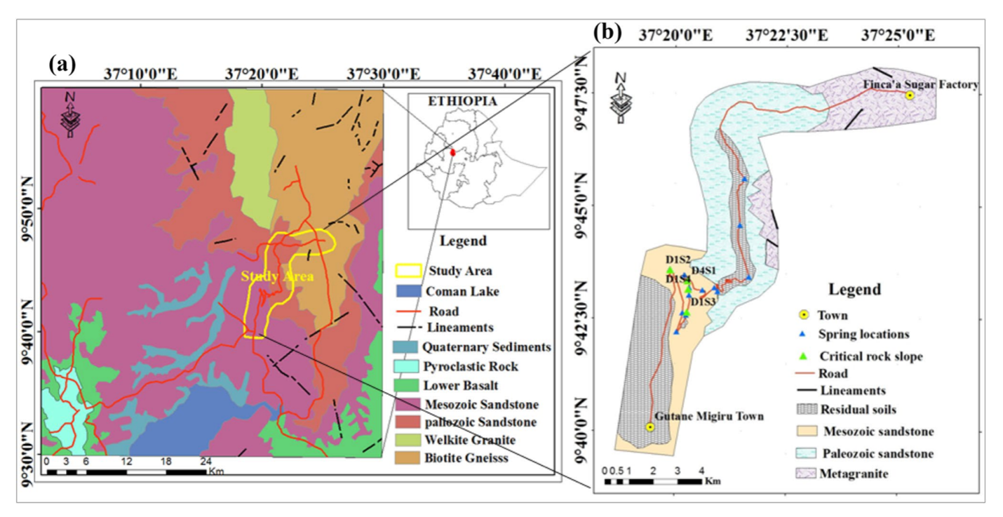
Landslides are a recurring hazard across Ethiopia. In the past decade alone, they have damaged over 100 km of asphalt roads, claimed around 300 lives, destroyed more than 200 homes, and affected nearly 500 hectares of land. One particularly affected route is the road linking Gutane Migiru to the Fincha sugar factory in Oromia – the area highlighted in the paper. During the rainy season, this stretch of road faced repeated disruptions from rockfalls and slope instability, jeopardizing both public safety and economic continuity.
These failures weren’t isolated incidents. Planar, wedge, and rockfall failure modes occurred frequently, with the road becoming impassable at times. As a result, assessing and mitigating the slope stability risks along this corridor became a top engineering priority.
The Geological Setting and Material Properties
The road corridor traverses three main rock types, with the most instability concentrated in sections composed of weathered Mesozoic sandstone. Lineaments with orientations of NNE, NNW, and NS were observed.
Environmental factors further complicate stability. Mean monthly rainfall reaches 322 mm during the wet season (July–September), correlating closely with peak failure periods. According to Ethiopia's seismic risk map, the study region lies in a seismic zone characterized by a 7MM intensity scale and a horizontal ground acceleration of 0.08g.
A comprehensive field survey was conducted to assess the geological structures, rock types, in situ rock strength, and groundwater conditions of the slopes. Field and lab tests were used to determine material properties. In the field, UCS was determined in situ using Schmit hammer testing, and the joint roughness coefficient (JRC) was visually evaluated. Rock samples were subjected to point load tests to calculate UCS. Parameters for Mohr-Coulomb strength criterion were developed using RocData, incorporating JRC, joint wall compressive strength, slope height, basic friction angle, and rock unit weight. Basic friction angle was sourced from RocData tables, while other parameters were field- and lab-derived.
Kinematic and Limit Equilibrium Analyses
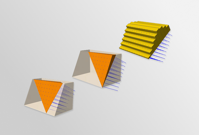
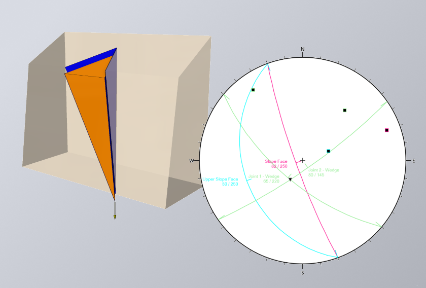
To assess slope stability along the Fincha access road, engineers first conducted a kinematic analysis using DIPS to verify the observed failed modes and identify failure-prone zones. These insights informed further limit equilibrium modelling (LEM) using RocPlane for planar failures and Swedge for wedge failures.
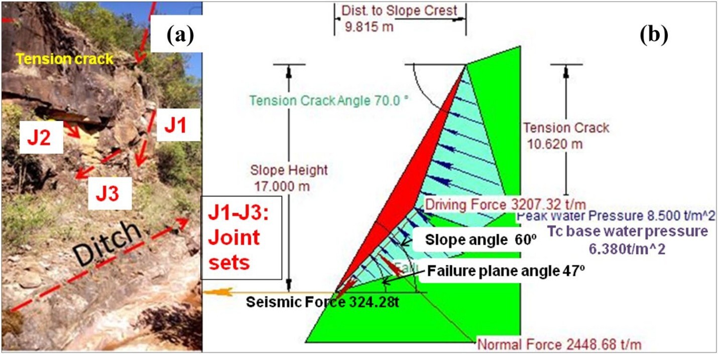
During detailed field investigations, four major rock slope failures – designated D1S2, D1S3, D1S4, and D4S1 – were recognized based on visible signs such as scarp formations, ground cracks, and adverse orientations of key rock discontinuities.
The DIPS analysis highlighted wedge failure at slope sections D1S2 (intersection of joint sets J2 and J4) and D1S3 (J1 and J2). Planar failure was also identified for sections D1S4 (due to J2 and J4) and D4S1 (J1).
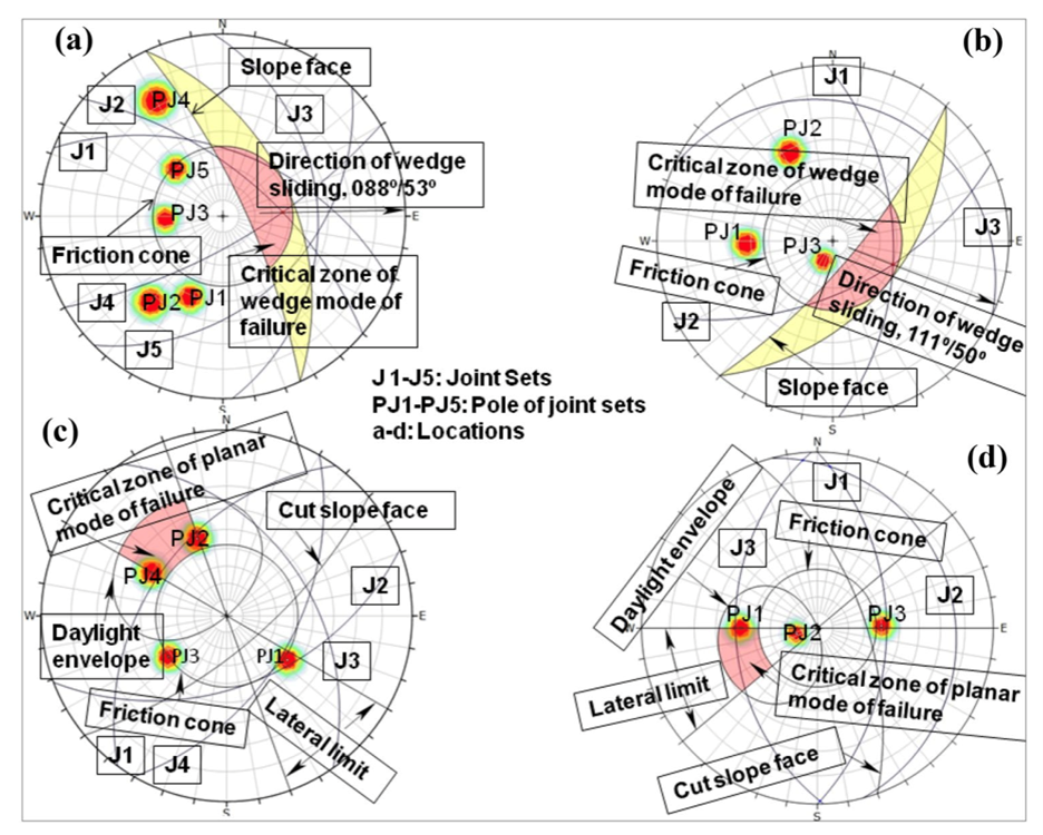
The factor of safety (FS) for each of the identified failure sections was calculated in RocPlane and SWedge for the planar and wedge failures, respectively. Key findings included:
- D1S4 (planar failure) showed an FS consistently below 1.0 in all conditions, signalling imminent failure risk.
- D4S1 (planar failure) approached instability under dynamic conditions but remained stable in static states.
- D1S2 and D1S3 (wedge failures) were unstable across all modelled conditions. Both were located in steep, cliff-forming sandstone, contributing to higher susceptibility.
These simulations confirmed that three of the four sections posed immediate safety concerns and required intervention.
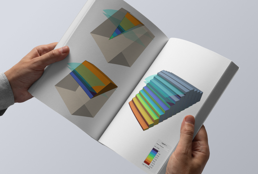
Validating Legacy Tools in RocSlope2
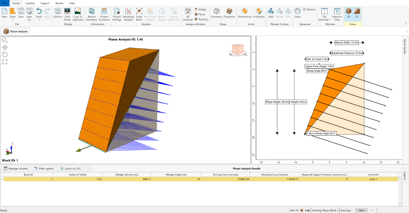
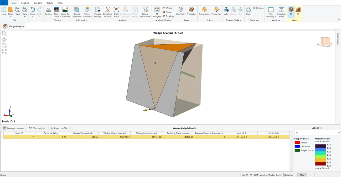
In the original study, analyses were performed using SWedge and RocPlane to estimate the safety factors for critical planar and wedge blocks along the analyzed sections and propose remediation strategies if needed. Using RocSlope2 – which integrates the capabilities of both tools – we recreated the same models matching the results and could also successfully apply the suggested remediations to arrive at the same results.
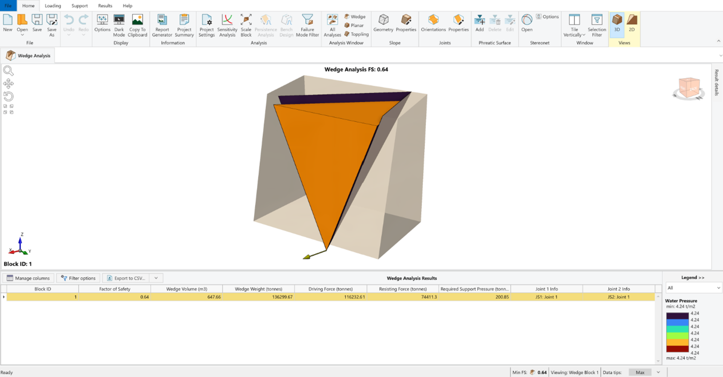
By reproducing the initial models from SWedge and RocPlane, RocSlope2 demonstrated equal reliability and capability in performing deterministic wedge analysis, with more advanced analytical tools and enhanced user experience.
Slope Section |
Joint Set(s) |
Dynamic Dry FS |
Dynamic Saturated FS |
Static Dry FS |
Static Saturated FS |
||||
RocPlane |
RocSlope2 |
RocPlane |
RocSlope2 |
RocPlane |
RocSlope2 |
RocPlane |
RocSlope2 |
||
DS14 |
J2 |
0.77 |
0.77 |
0.76 |
0.76 |
0.91 |
0.91 |
0.90 |
0.90 |
J4 |
0.65 |
0.65 |
0.64 |
0.64 |
0.77 |
0.77 |
0.76 |
0.76 |
|
D4S1 |
J1 |
1.04 |
1.04 |
1.00 |
1.00 |
1.22 |
1.22 |
1.18 |
1.18 |
Table 1. An overview of the planar stability analysis conducted for various slope conditions. Note the FS on the right, where the original data from RocPlane is recorded alongside the validated results in RocSlope2.
Slope Section |
Joint Set(s) |
Dynamic Dry FS |
Dynamic Saturated FS |
Static Dry FS |
Static Saturated FS |
||||
SWedge |
RocSlope2 |
SWedge |
RocSlope2 |
SWedge |
RocSlope2 |
SWedge |
RocSlope2 |
||
D1S2 |
J2 - J4 |
0.65 |
0.65 |
0.64 |
0.64 |
0.77 |
0.77 |
0.76 |
0.76 |
D1S3 |
J1 - J2 |
0.67 |
0.67 |
0.66 |
0.66 |
0.78 |
0.78 |
0.77 |
0.77 |
Table 2. An overview of the wedge stability analysis conducted for various slope conditions. Note the FS on the right, where the original data from SWedge is recorded alongside the validated results in RocSlope2.
Conclusion
The Fincha Sugar Road project is a strong example of modern rock slope stabilization – where field investigation, kinematic analysis, and simulation-based design work together in real-world conditions. In the original study, engineers used SWedge and RocPlane to assess failure modes and proposed targeted remediation strategies.
In this follow-up, we rebuilt the same models using RocSlope2, which combines the capabilities of both tools. The outcomes were consistent: failure mechanisms were accurately modelled, remediation strategies held, and slope stability was restored in high-risk zones. More importantly, the original designs stood up to scrutiny under a newer, more integrated platform.
As infrastructure continues to expand into geologically complex, failure-prone regions, the demand for tools that balance precision, speed, and real-world usability will only grow. This case reinforces the idea that when slope stability is treated not just as a hazard to avoid, but as an engineering opportunity, the result is both scalable and sustainable – transforming unstable terrain into resilient transport corridors.
Build Safer Slopes with Confidence
See how Rocscience tools like RocSlope2 can help you assess and mitigate complex slope failures.
Start your free trial today.