3vGeomatics InSAR data now in Rocscience 3D Slope Stability Suite
October 2020
Solidify your analysis using Slide3 and RS3.
Toronto, ON: 3vGeomatics (3vG) and Rocscience bring together the power of InSAR (interferometric synthetic aperture radar) data with the advanced slope stability analysis of Slide3 and RS3.
As the InSAR leader in mine monitoring, 3vG processes more than 2000 reports a year for clients in over 50 countries around the world. Leveraging client feedback and extensive R&D, 3vG developed InSAR monitoring innovations for their clients that give better coverage, higher precision, near real-time actionable intelligence that is easier to use and more relevant in reducing geotechnical risk. 3vG continues to lead the expansion of InSAR applications beyond mining into new sectors with new solutions.
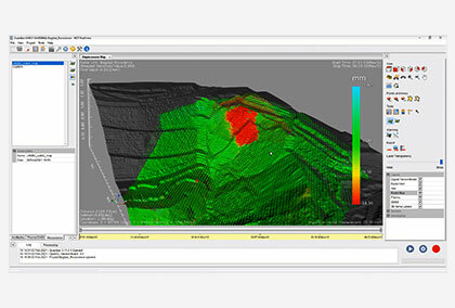
The integration of 3vG’s tailored solutions into Slide3 and RS3 continues to improve the accessibility of InSAR by synchronizing disparate data sources into your platform of choice. Users can view, analyze, and interact with the remotely sensed measurements by selecting 3vG InSAR Data from the import tool.
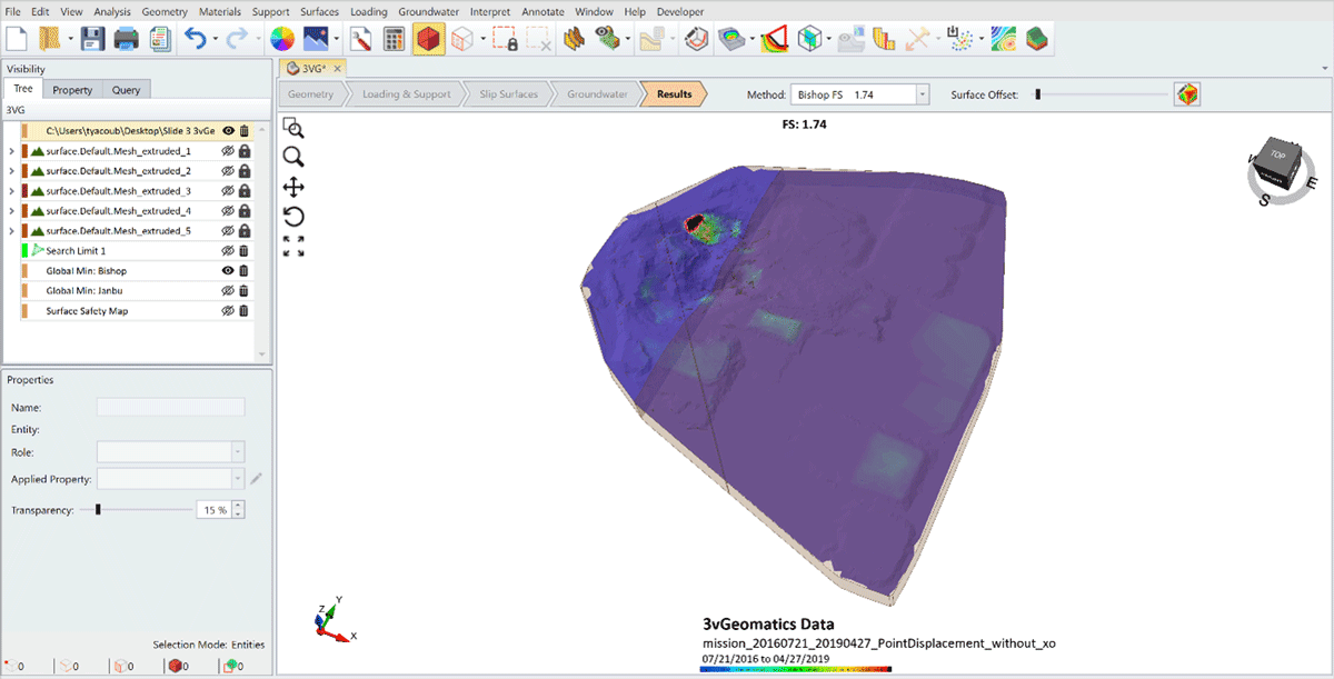
The benefits of compiling 3vG’s data with modelled slope mechanics allow for continued improvements to the accuracy and precision of 3D slope design. 3vG’s InSAR data is capable of millimetric precision, leading to increased reliability of quantitative modelling. The latest Maintenance+ update of Slide3 and RS3 will allow Rocscience users to easily import 3vG’s InSAR results to be overlaid onto their models to accurately establish the Factor of Safety and Probability of Failure. On the other hand, users can also use this radar data to conform their models during and after the excavation to ensure there is no event of slope failure due to any instability.
3vG’s industry-leading innovation together with Rocscience’s proven track record in slope modelling software continues to build the foundation for safe mining practices. This integration expands the horizon of geomechanic modelling for geotechnical engineers, mine owners, and planners by creating unified accessibility.
This collaboration between Rocscience and 3vG is a big step towards achieving “intelligent slope design”. Engineers will now benefit from the efficient use of predictive modelling together with radar data to perform advanced calibration to make their models highly reliable.
About 3vGeomatics: 3vG was founded in 2007 with the mission of making InSAR an easily accessible and useful technology for a broad base of users. At that time, InSAR results were delivered infrequently, based on images collected months prior, and applicable only in ideal conditions. It was very much a “nice to have” service. By listening to our customers’ requirements and investing heavily in R&D, we focused on delivering displacement data that could be better integrated into our clients’ existing workflows.
About Rocscience: Founded in 1996, Rocscience is a world leader in developing 2D and 3D software for civil, mining, and geotechnical engineers. For over 20 years, we’ve built on leading-edge research to create the best geotechnical software available. As engineers ourselves, we know the importance of having reliable and easy-to-use software. That’s why we constantly develop and refine our programs to make expert solutions that work for you.