
Rockfall
& Hazard
Simulate rockfall trajectories, assess hazard zones, and plan mitigation strategies with confidence.
Helping engineers move from site mapping and field observations to quantitative rockfall and hazard assessments.
Integrating slope geometry, discontinuity orientation, runout analysis, and barrier or catch-ditch design to make it easier to compare alternatives and document why a chosen mitigation strategy meets project risk and safety targets.

Developed for Confident Rockfall and Slope Hazard Assessment
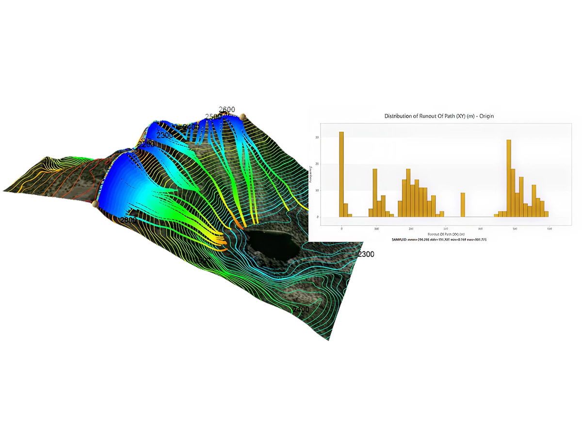

Simulate rockfall over complex terrain with RocFall3 and RocFall2, assessing trajectories, energies, and runout in 2D and 3D to define impact zones, hazard areas, and risk to nearby infrastructure.
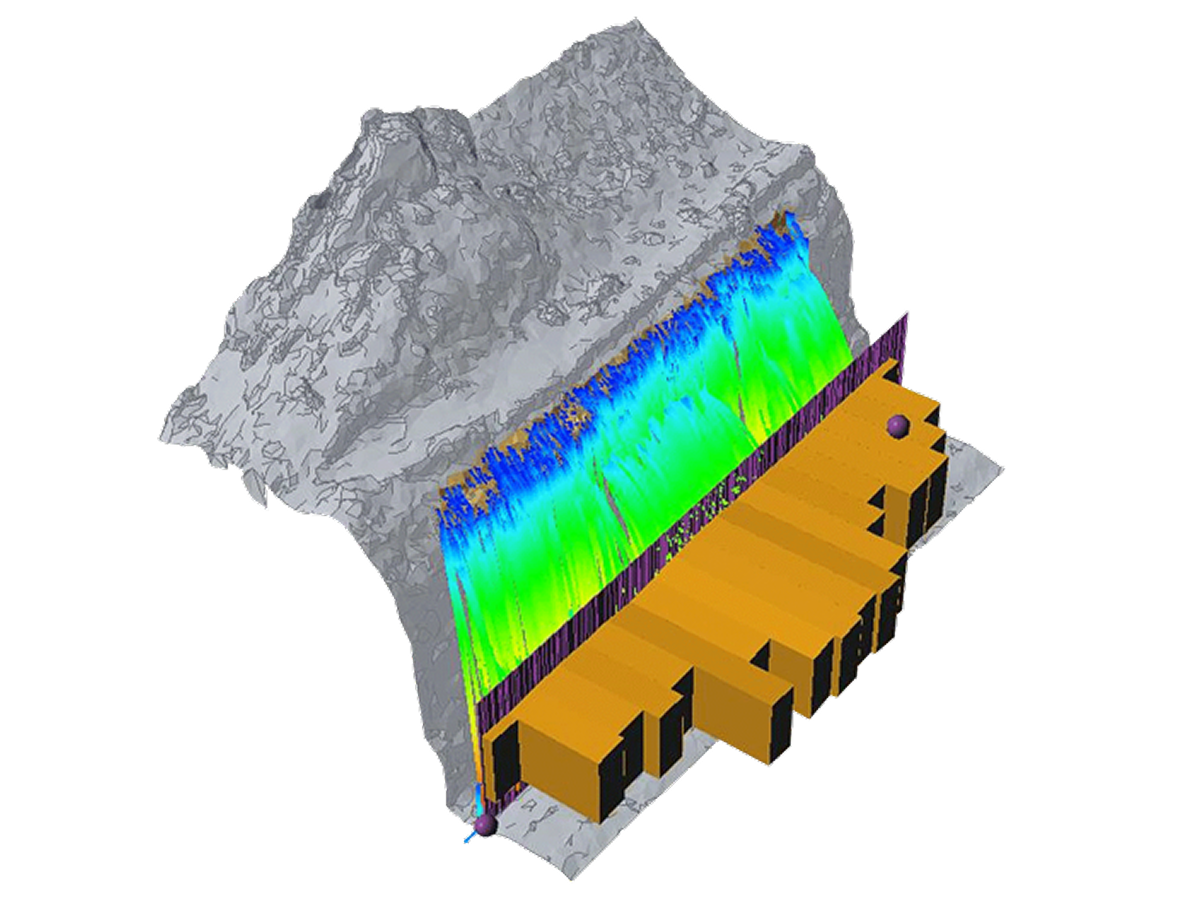
Optimize the placement, type, and capacity of barriers and catchment structures using energy, bounce height, hit counts, and pass/fail statistics to match anticipated rockfall magnitudes and paths.
Create hazard maps by combining 3D trajectory results with site topography and infrastructure, using intensity and energy heatmaps to highlight highest‑risk areas and prioritize mitigation.
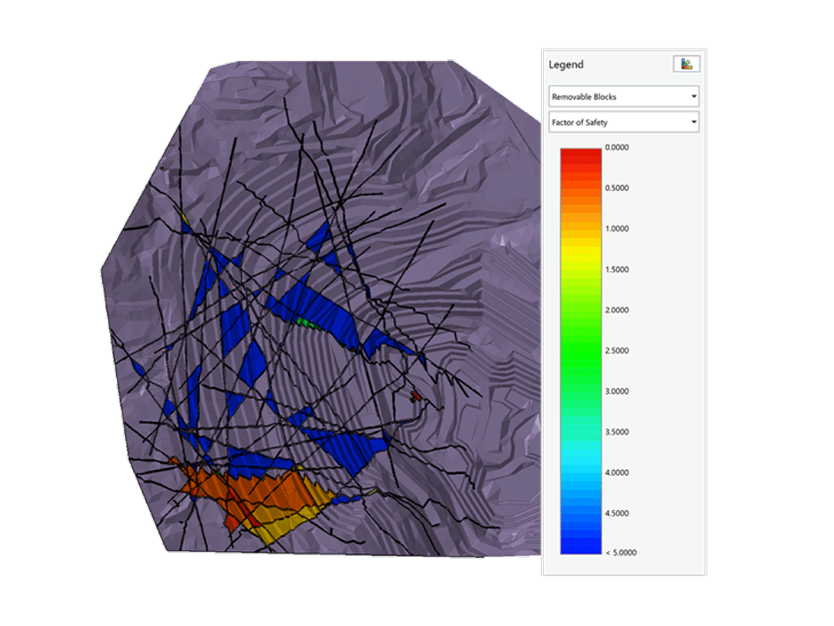
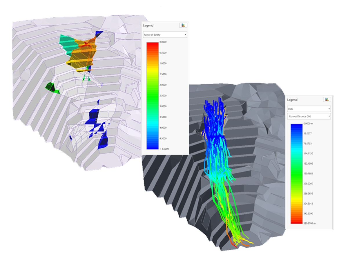
Link RocSlope3 and RocFall3 to carry block initiation points directly into trajectory analysis, tracing behavior from detachment to runout for more precise barrier and hazard‑zone design.
Capture variability in block properties, initiation zones, and slope conditions with probabilistic or scenario‑based runs in RocFall2 and RocFall3, using runout distributions and impact zones to guide risk‑aware mitigation decisions.