The Latest Features in RocFall3
RocFall3 is a powerful software for 3D assessment of slopes at risk of rockfalls. Building off the tools and functions found in RocFall2 (formerly RocFall) and harnessing the same 3D features established in Slide3 and RS3, RocFall3 provides insights into your models like no other software.
Stay up to date with the latest RocFall3 features and integrations that you can incorporate into your geotechnical analyses.
March 2022
Expanded rock shape library for rigid body analysis
The rigid body analysis in RocFall3 now supports the use of regular polyhedrons and extruded polygons for an enhanced statistical simulation of rockfalls in 3D. Model falling bodies using a variety of shapes and view their trajectories and motions through 3D animation. The 3D rigid body simulation in RocFall3 is compatible with the 2D rigid body simulation in RocFall2.
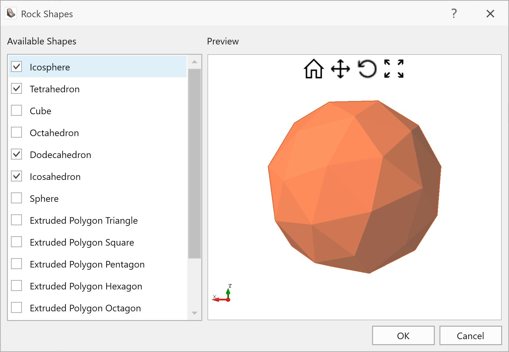
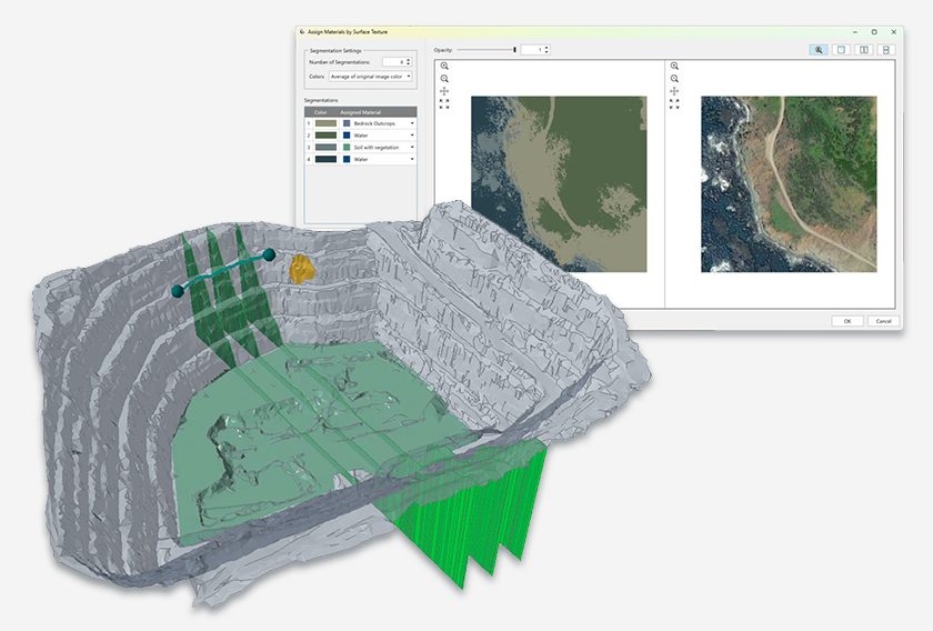
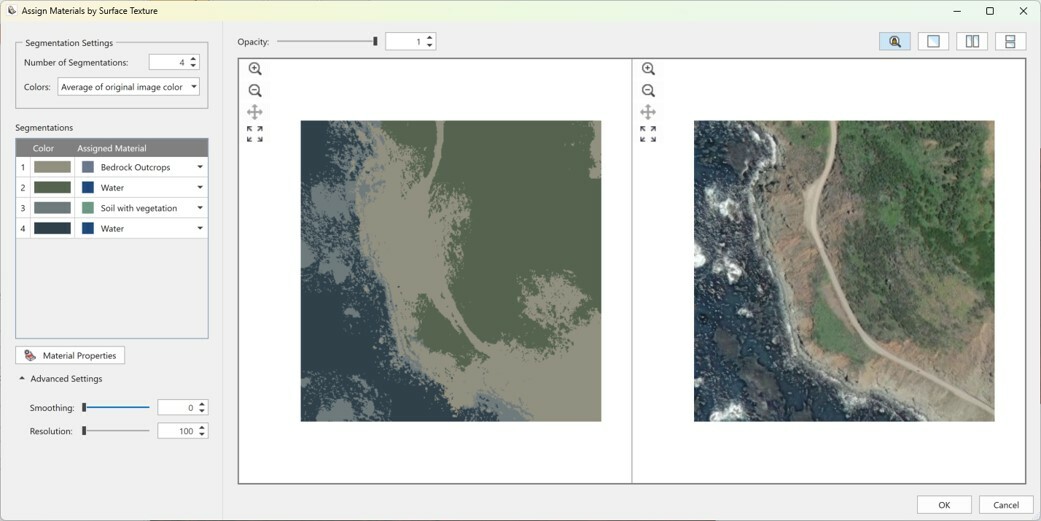
Image segmentation
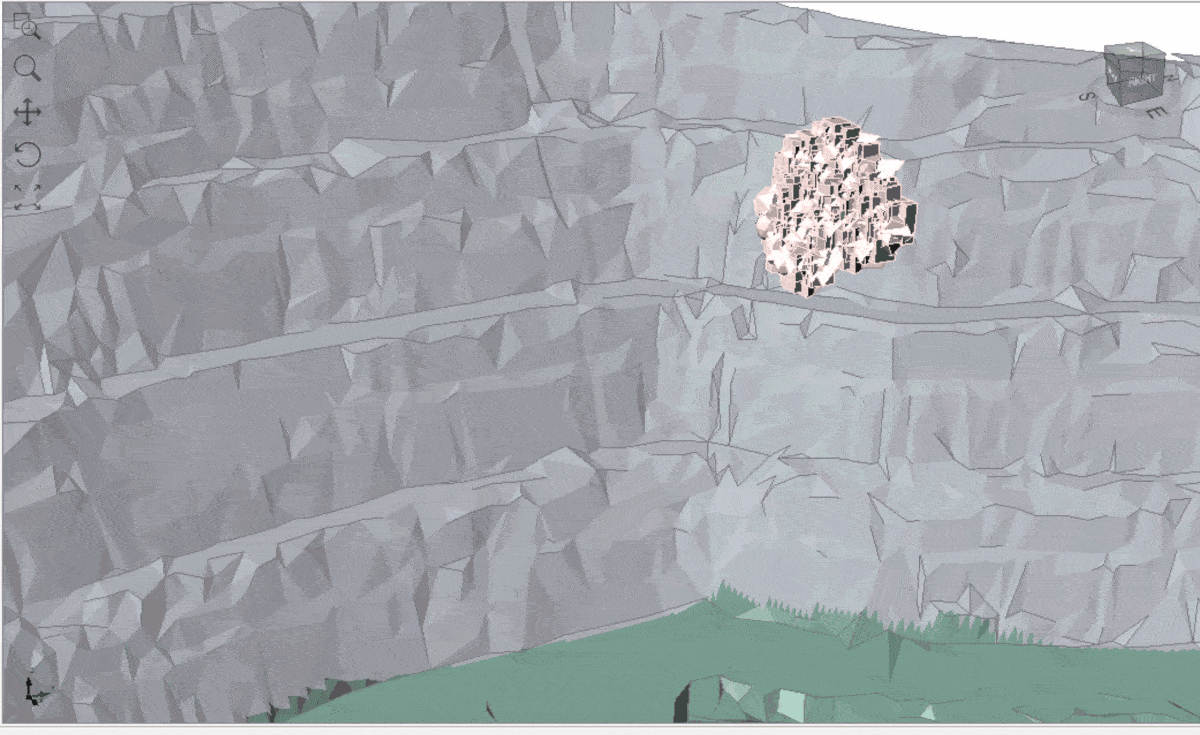
The new image segmentation tool in RocFall3 is designed to automatically suggest a slope surface material assignment based on a surface texture. This will help save model construction time, especially for large models with complex geology. Slope textures can be imported as common image files or by using the in-program terrain generator option.
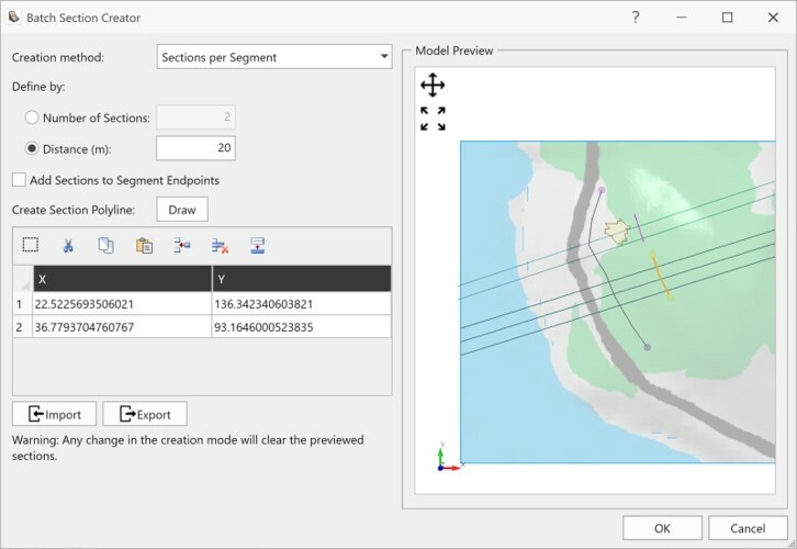
Multi-section export
Create and export multiple slope sections from RocFall3 for group analysis in RocFall2. Group plots in RocFall2 are useful for comparing the relative hazard of rockfalls among multiple slope sections. Improve integration between 2D and 3D analyses.
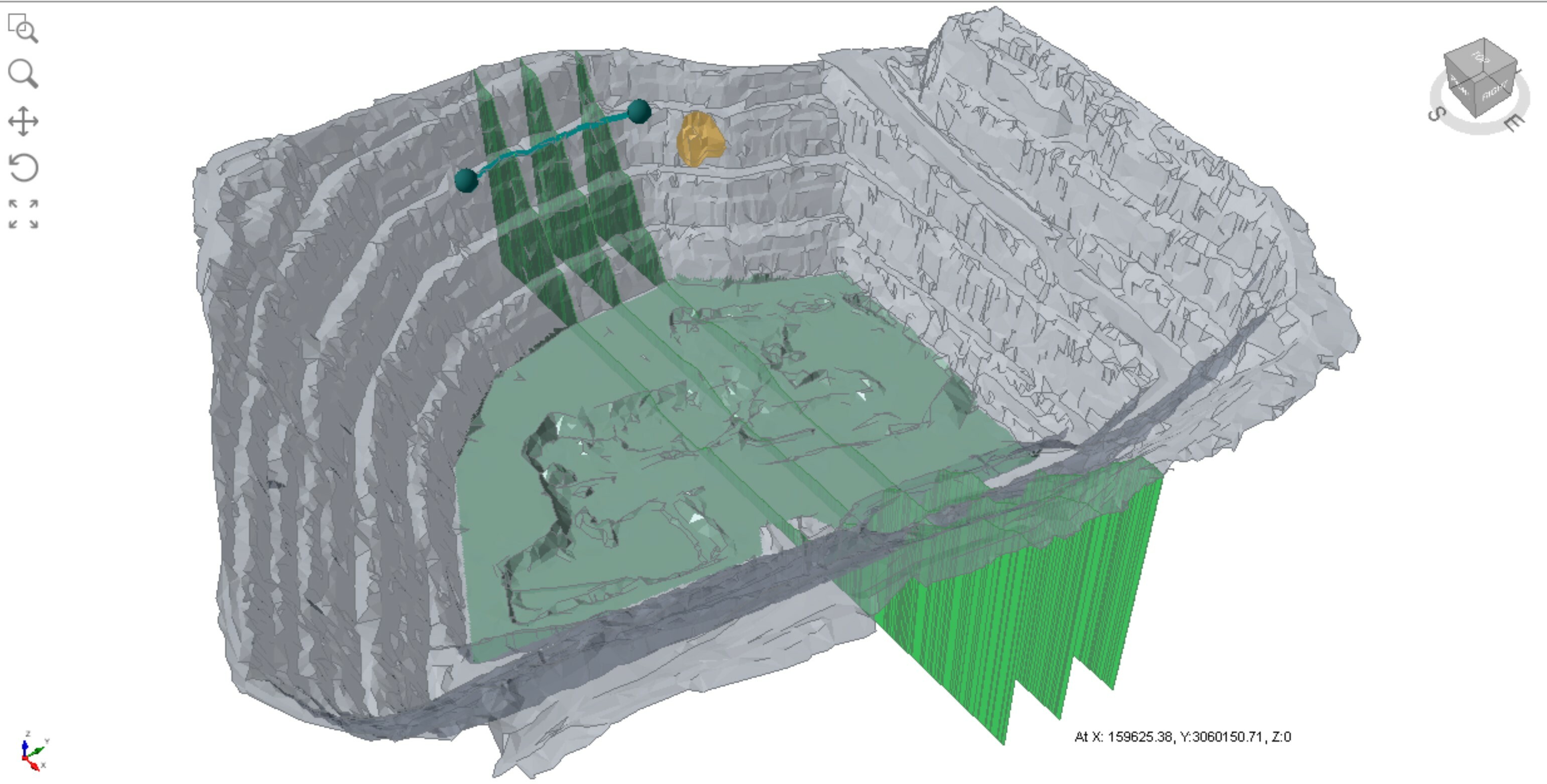
Area seeders
Falling body origins in RocFall3 can now be defined with point seeders, line seeders, plane seeders, and area seeders. Area seeders are the most suitable option for modelling geologic origins of falling bodies that span irregular areas.
Reference line for runout distance analysis
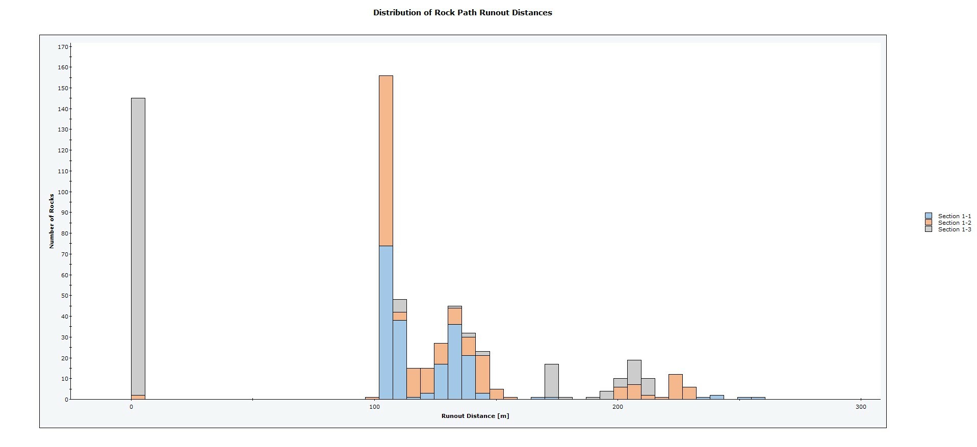
Rock runout distances calculated from a reference polyline can be meaningful to the analysis and design of mitigation measures. This reference line can be a user-drawn polyline or a modelled rockfall barrier. Reference lines are created in RocFall3 but can also be exported to RocFall2 for group analysis of runout distances among multiple slope sections.
March 2022
Barriers
Analysis of rockfall stabilization measures is crucial to any slope design. RocFall3’s barrier logic is designed after RocFall2 which includes an unlimited number of barriers, deformable barriers, energy capacity, elongation, and adjustable height.
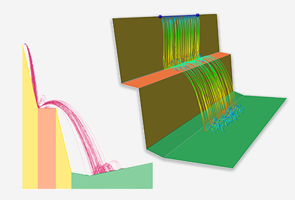
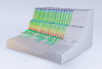
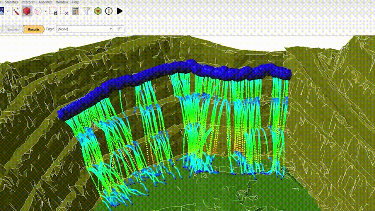
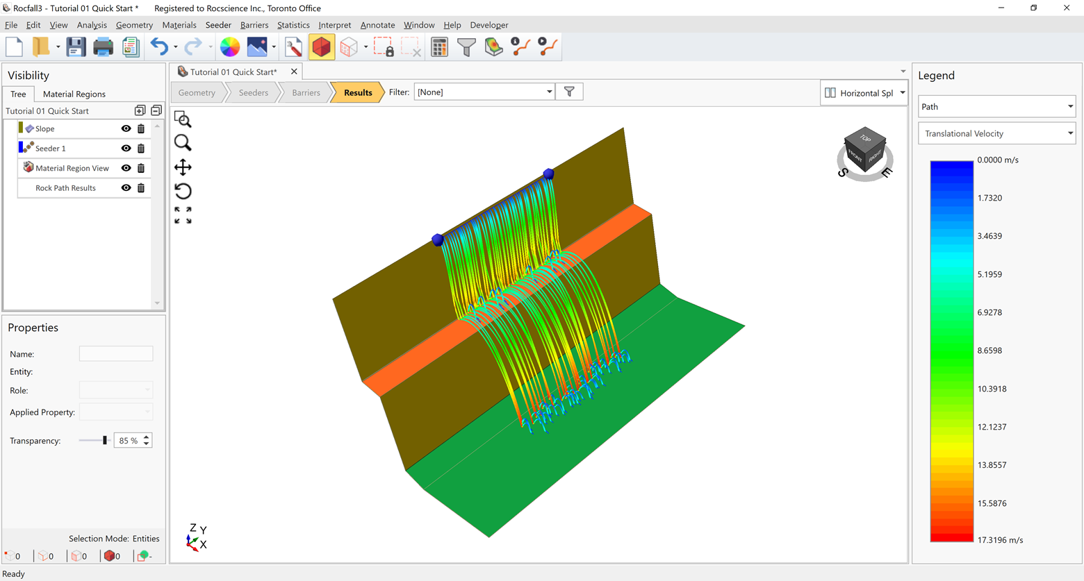
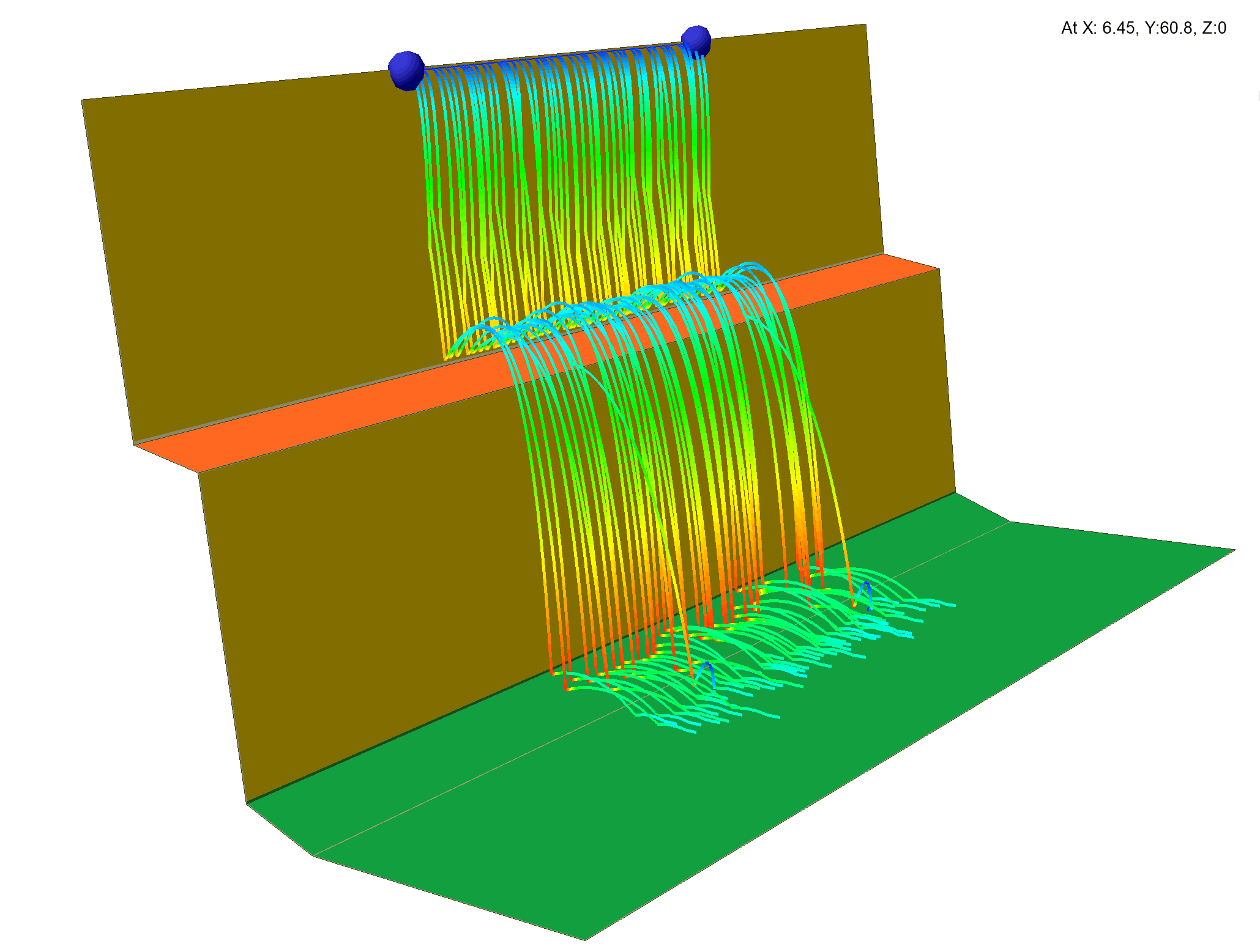
Rockfall Data Visualization
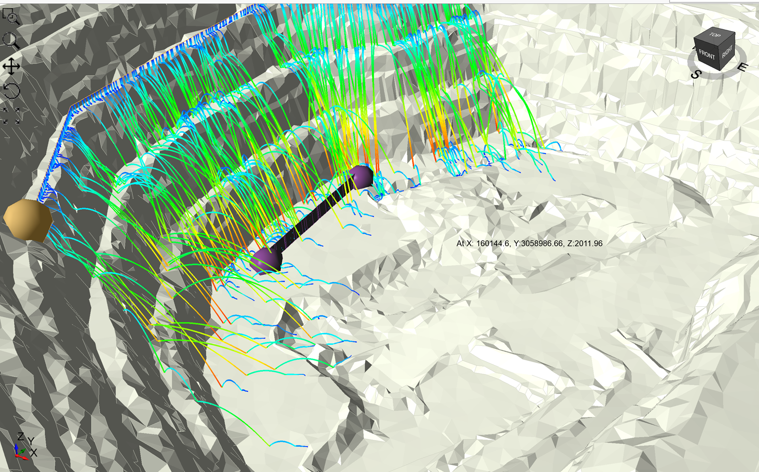
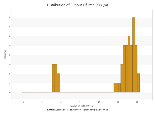
The ability to easily visualize and interpret analysis data is crucial for any rockfall model. RocFall3 allows you to view rock paths, trajectory, and final stopping location. It can also contour various data like energy and bounce height along the path while plotting runout distributions and spatial distribution of stopping location. RocFall3’s suite of visualization tools includes runout distributions, barrier statistics, and easy filtering of data for your analysis.
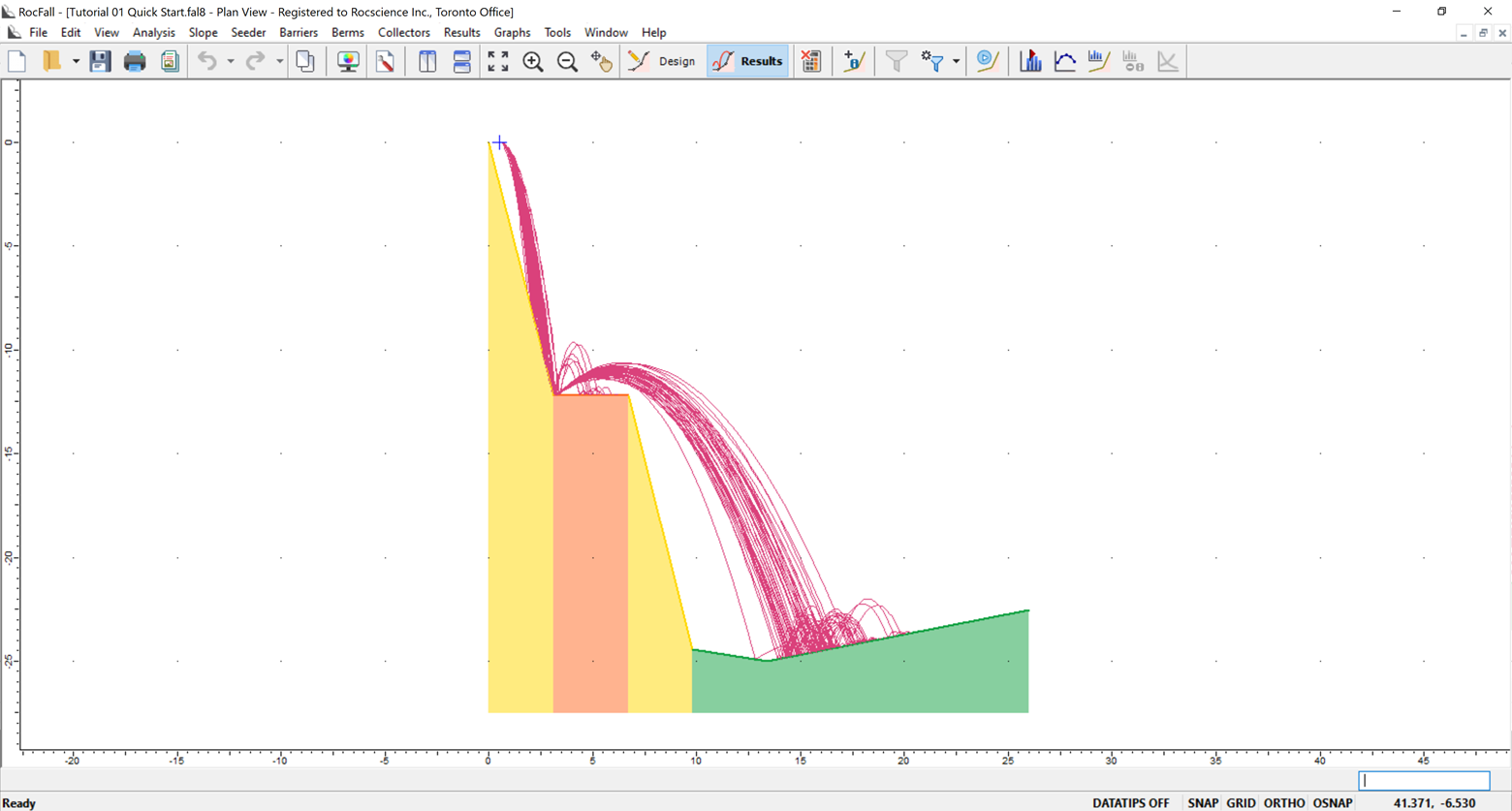
Integration with RocFall2
The integration of RocFall3 with its 2D counterpart RocFall2 allows you to import models directly from RocFall2 and extrude the geometry to easily create a 3D model. You can also define a 2D section within a full 3D model and export it back to RocFall2 with predefined materials and parameters to seamlessly run 2D analysis.
February 2022
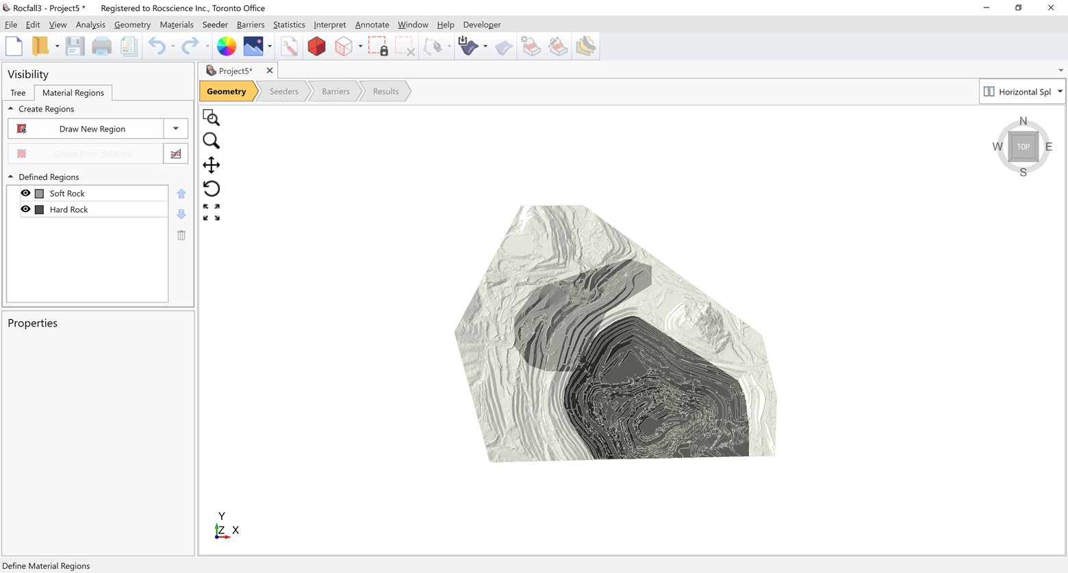
Material Region Editor
The material region editor lets you select regions on the slope surface and apply material properties quickly and easily. You can select the area based on elevation, user-defined polygonal regions, or the various built-in triangle selection facilities available in the Rocscience suite of programs. When importing RocFall2 models, your material regions are created automatically.
January 2022
Lumped Mass and Rigid Body Analysis
Like RocFall2, RocFall3 consists of both lumped mass and rigid body analysis methods. The lumped mass model includes impact and sliding physics, whereas the rigid body engine has a sphere impact model. Both lumped mass and rigid body physics engines can scale the coefficient of restitution (Rn) by velocity and mass.
December 2021
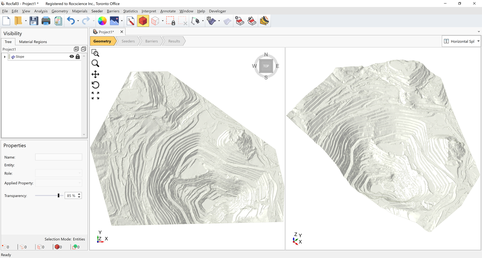
3D Model Creation
Constructing rockfall models is easier and faster than ever. Import ground surfaces from geological modelling or mine planning software along with digital elevation models from various sources in industry-supported file formats (obj, dxf, stl, dtm, etc.).
The Terrain Generator allows you to import digital elevation models from satellite data. Using RocFall3’s built-in surface construction methods, you can build surfaces from point cloud data, elevation data, polyline lofting, or by extrusion.
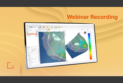
Learn RocFall3
Explore the RocFall3 user guide for in-depth instructions on how to use the program and visit our library of learning resources which includes case studies, past webinars, and articles, designed to expand your geotechnical knowledge and help you get the most out of your analysis.