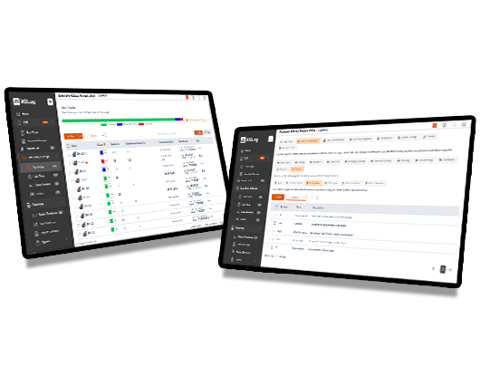
RSLog
Web-Based Borehole Log Management Software
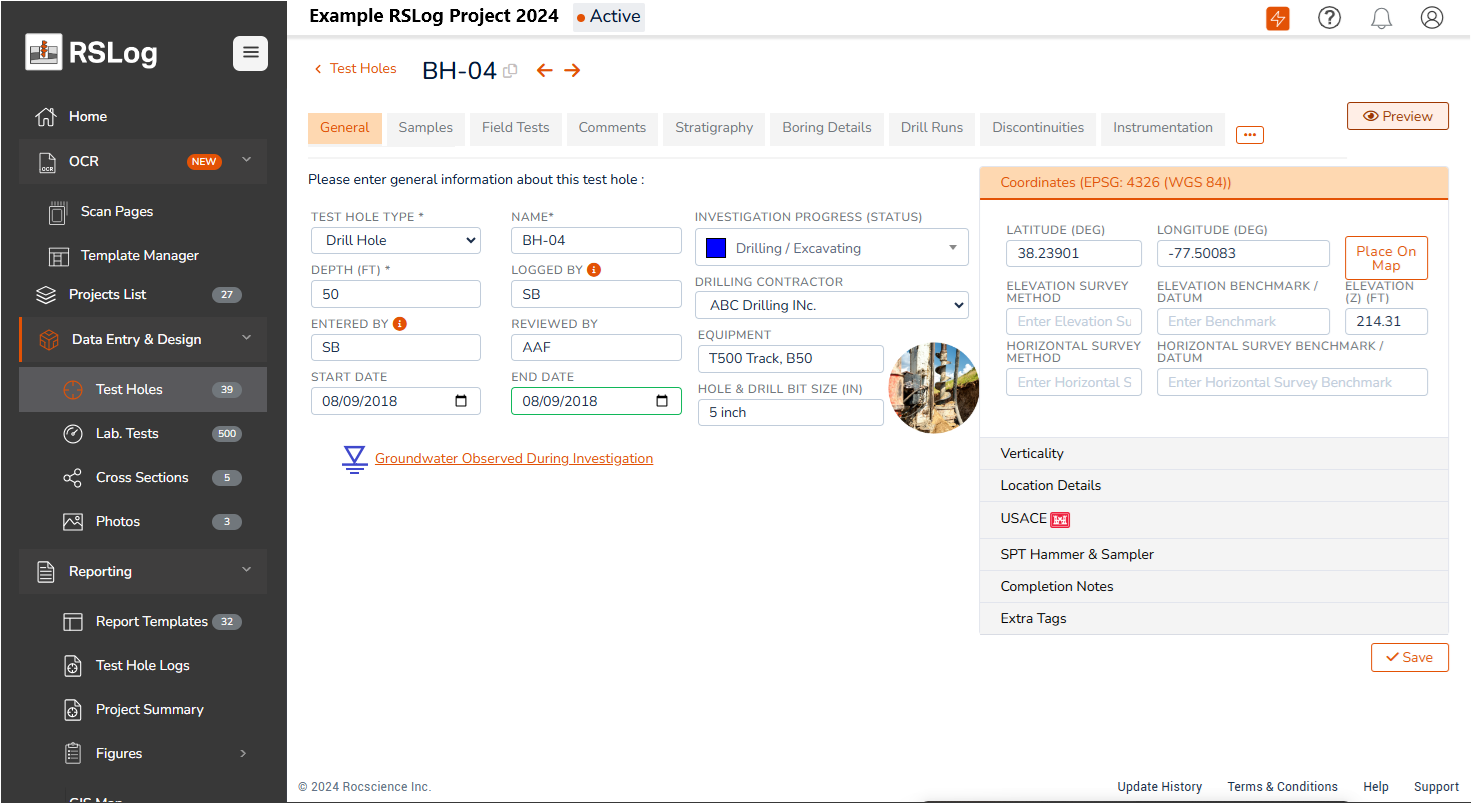
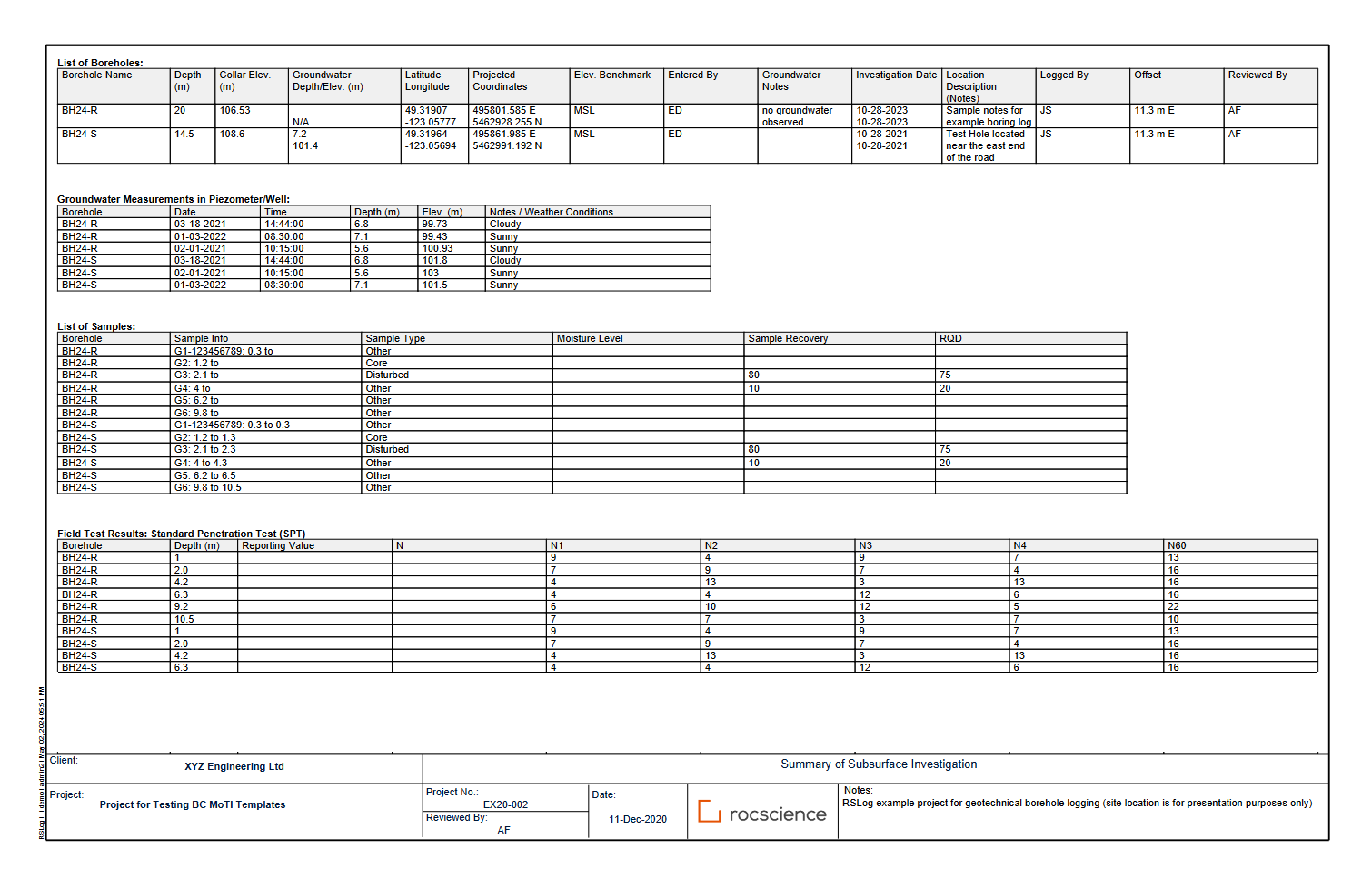
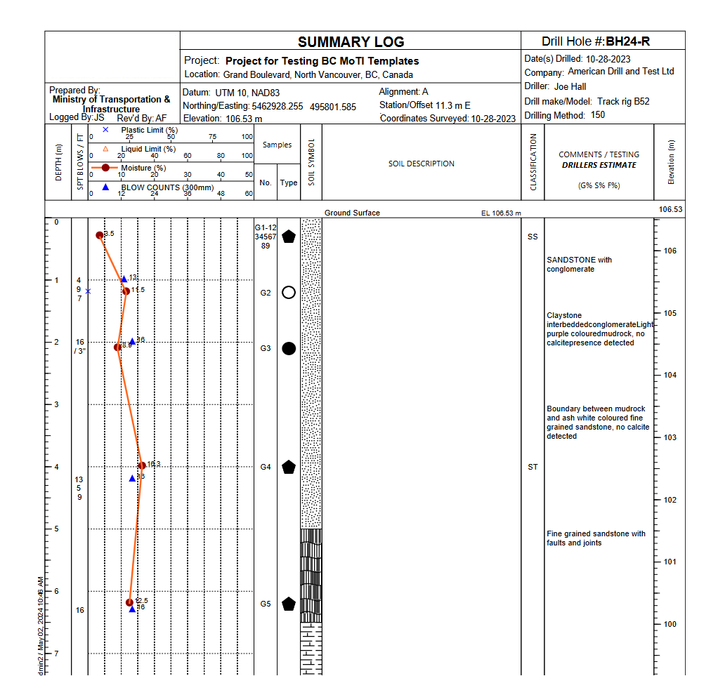
Centralizes your borehole data and streamlines collecting, reviewing, and preparing borehole logs, both in the office and on the field.

RSLog Across Applications
Field Data Collection
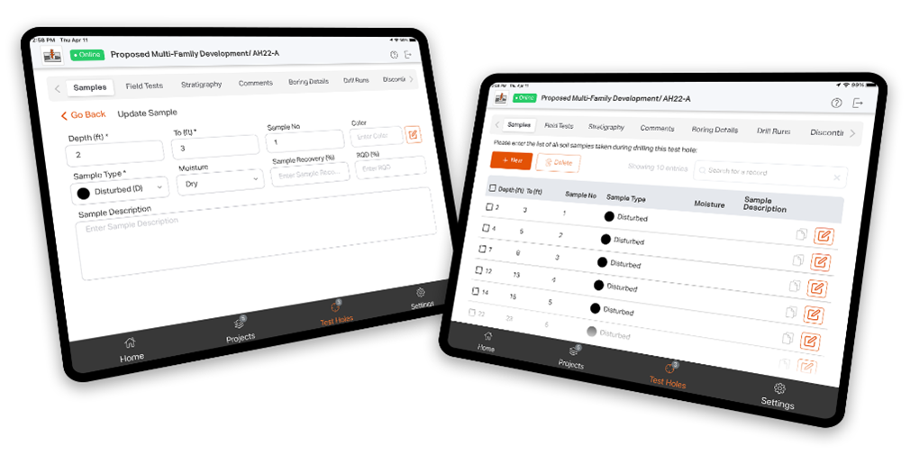
RSLog OnSite is a free iOS/Android app that streamlines field data collection during site investigation. It has an easy-to-use interface and seamlessly connects with your RSLog account, saving the time you would have spent uploading field data.
OnSite can record anything from borehole locations to samples, field tests and stratigraphy. You don’t need an internet connection during data collection; to share data with your colleagues, just sync with RSLog when you’re connected.
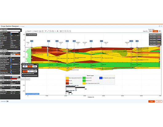
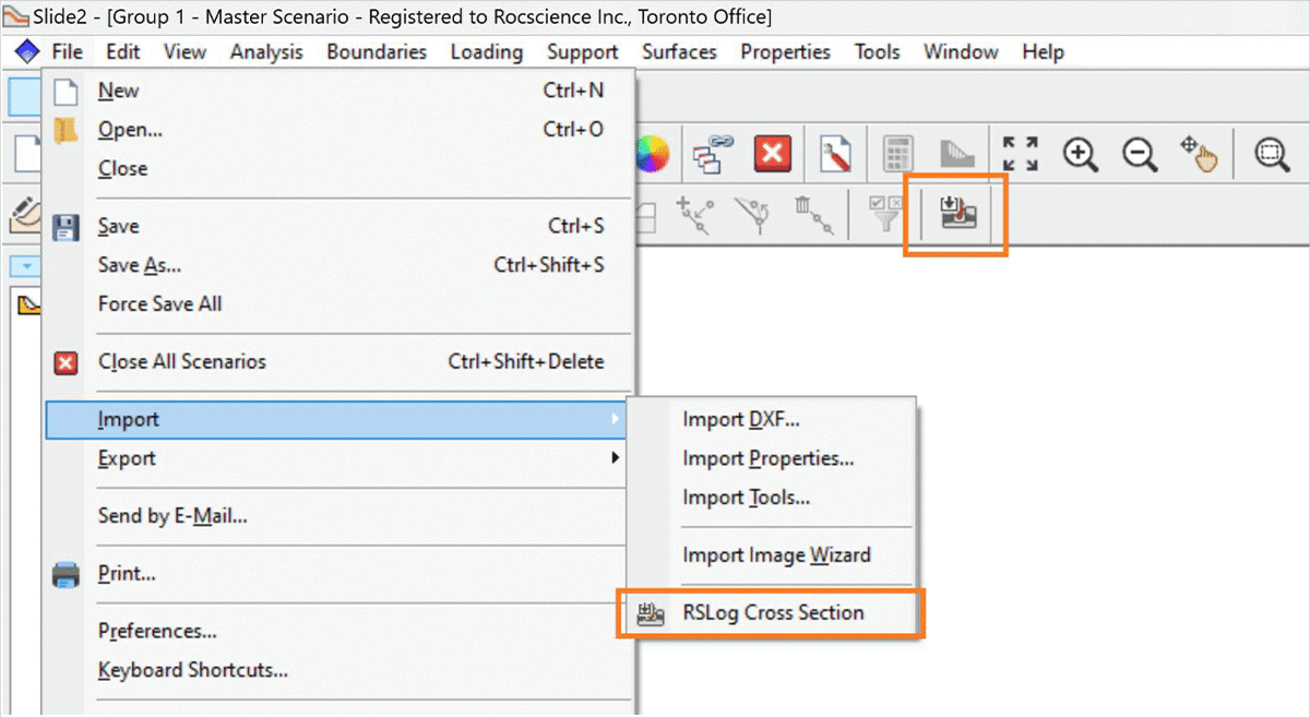
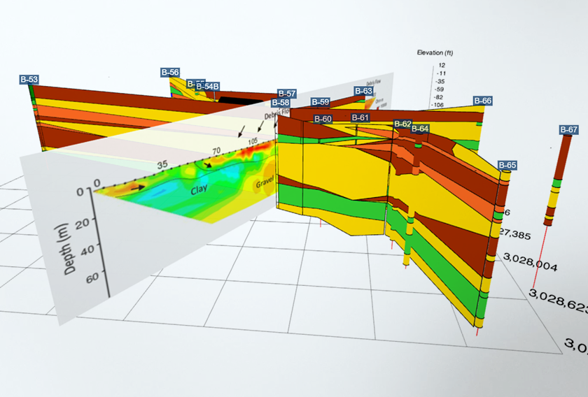
Subsurface Visualization
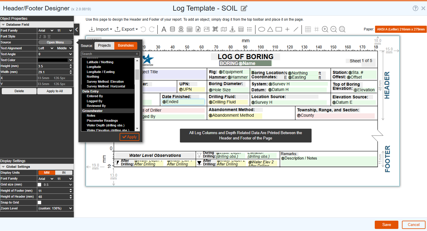
Easily create cross-sections using centralized borehole data. RSLog has several features that help you apply engineering judgment and local geology knowledge to create stunning 2D and 3D designs, transferrable to AutoCAD, Civil3D, Google Earth, and more.
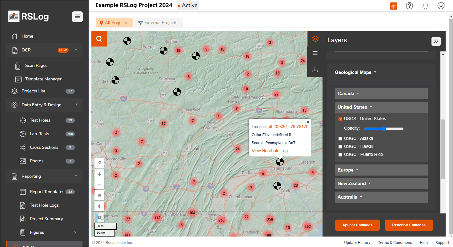
Departments of Transportation
RSLog revolutionizes data management for DoTs by centralizing cross-project data, encouraging seamless collaboration, and helping meet strict compliance and reporting standards.
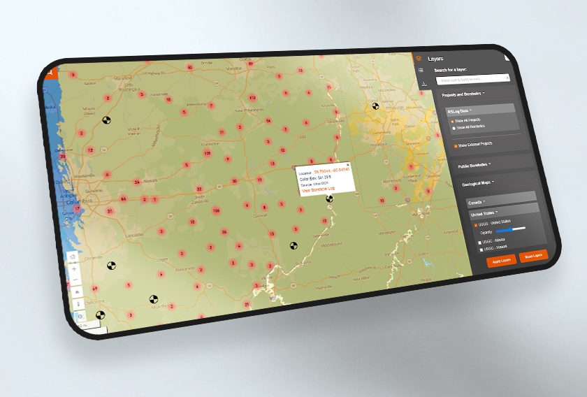
Improve your workday with streamlined data transfers with consultants and contractors, better team collaboration between the field and office, a powerful GIS map, easy user management, borehole data exported to construction drawings, and more.
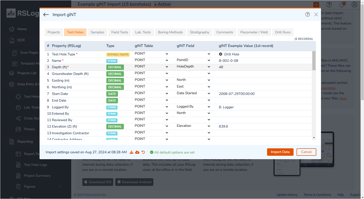
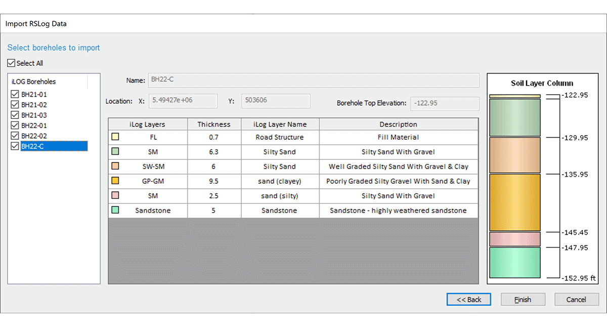
Easy Data Migration
Import your historic boreholes to RSLog easily. Whether your data is in gINT, DIGGS, Excel, JSON or any other format, our experienced team of database experts can help you find the best way to migrate your data.
RSLog Seamlessly Integrates With
The Latest Features
Grow With Our Learning Resources
article
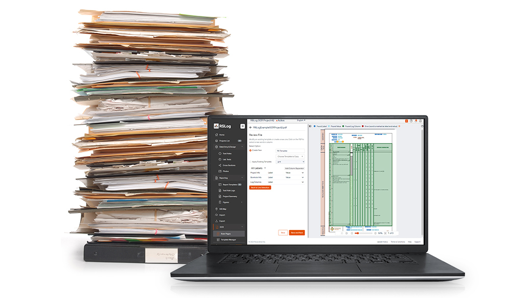
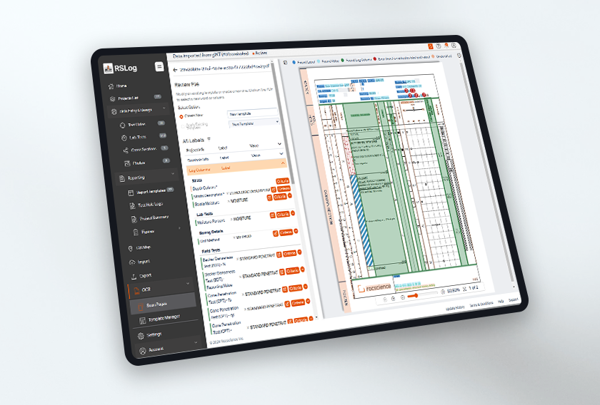
Using AI, RSLog’s New Optical Character Recognition (OCR) Feature Digitizes Paper Borehole Logs
article
The Value of Migrating Historic Boreholes into RSLog
article
RSLog Continues to Evolve With These Exciting Summer Updates
RSLog
Get RSLog today. Choose your license below:
Web Lease
Ongoing subscription- Maintenance+ subscription
- Ongoing bug fixes
- Continuous new features
- Access from any device
- Free 'Viewer' users
- Customized pricing for 10+ users
- Add-on OCR feature
Have questions about our pricing structure? View Plans & Pricing FAQ