Dips

Graphical and Statistical Analysis Software for Orientation Data

Provides stereographic projection for the interactive analysis of orientation-based geological data. Capable of kinematic and jointing analysis.

Free Trial

Dips

Graphical and Statistical Analysis Software for Orientation Data

Free Trial

Stereographic Projection Analysis

Designed for interactive analysis of orientation-based geological data. Visualize orientation vectors, density contours, planes, intersections, and traverses. Draw user-defined planes, sets, and annotative tools.

Dips
Dips

Stereographic Projection Analysis

Designed for interactive analysis of orientation-based geological data. Visualize orientation vectors, density contours, planes, intersections, and traverses. Draw user-defined planes, sets, and annotative tools.

Dips

Kinematic Analysis

Identify critical zones, vectors, and intersections on a stereonet overlay with the kinematic analysis of planar and wedge sliding, or direct and flexural toppling failure modes. Export kinematic results to Excel, containing critical vectors and intersections for all failure modes.

Jointing Analysis

Perform jointing analysis with three built-in options: Joint Spacing calculates true or apparent spacing between a set’s joints, RQD Analysis assesses Rock Quality Designation, and Joint Frequency counts joint occurrences along each 1D distance interval, on a linear or borehole traverse.

Dips
Dips

Jointing Analysis

Perform jointing analysis with three built-in options: Joint Spacing calculates true or apparent spacing between a set’s joints, RQD Analysis assesses Rock Quality Designation, and Joint Frequency counts joint occurrences along each 1D distance interval, on a linear or borehole traverse.

Check out the full list of technical features in Dips

See Specs

Dips Across Applications

  • Excavations
  • Mining
  • Tunnels
  • Rock Slopes

Excavations

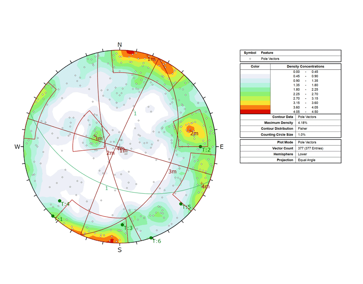
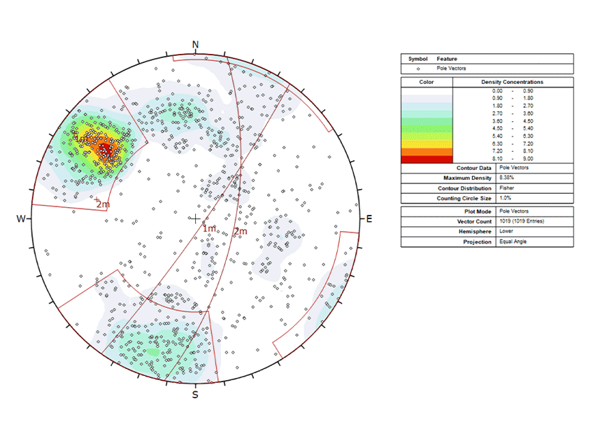
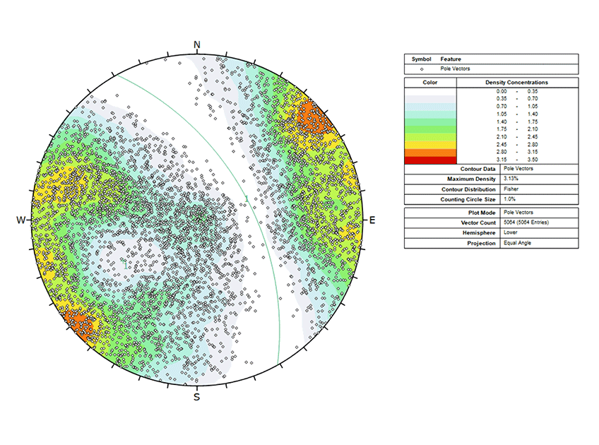
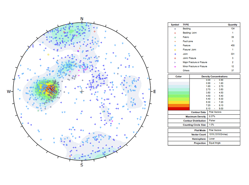
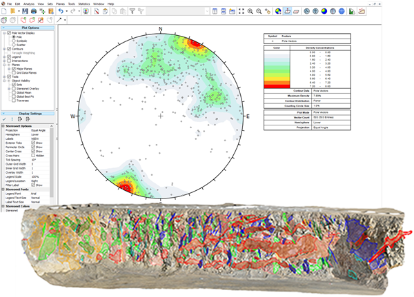
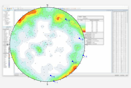
Identify critical joint sets, folds, and foliations in the rock structure using cluster analysis, fold analysis, and vector density contours.

Dips Excavations

Mining

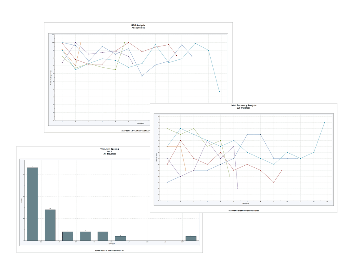
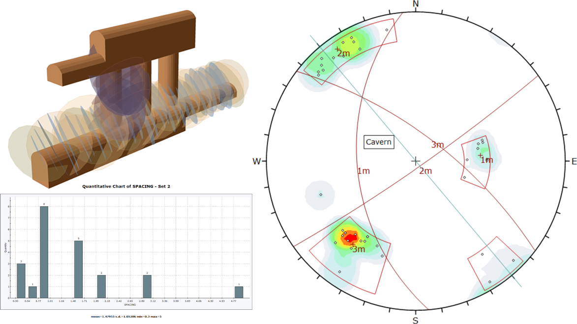
Quantify rock mass based on joint spacing, joint frequency, and RQD analysis collected along boreholes, scanlines, and wall mappings.

Dips Mining

Tunnels

Identify joint sets from discontinuity clusters with the aid of vector density contour visuals. Obtain mean set orientations and set statistics (such as Fisher K, Variability Limit, and Confidence Limit) for underground wedge analysis.

Dips Tunnels

Rock Slopes

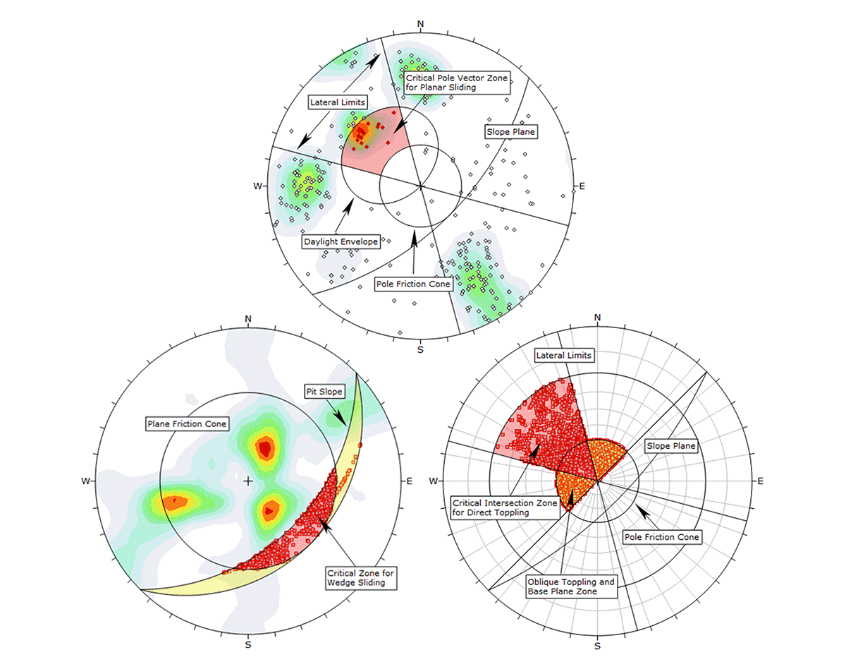
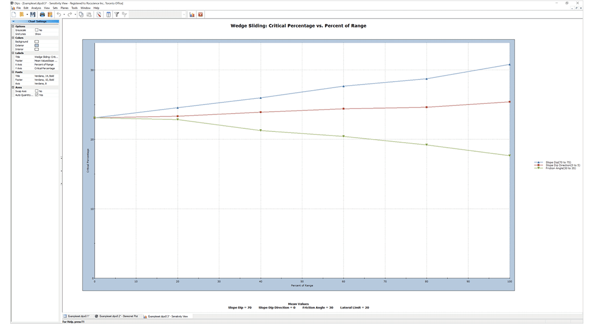
Define kinematic properties of the slope and identify critical planes and intersections for various rock slope failure modes: planar sliding, wedge sliding, direct toppling, flexural toppling.

Dips Rock Slopes

Dips Seamlessly Integrates With

  • SWedge
  • UnWedge
  • RocSlope3
  • ShapeMetriX

+

Import orientation data and set statistics from Dips in SWedge for deterministic, probabilistic or combination analysis.

Dips

+

Import orientation data and set statistics from Dips into UnWedge for deterministic, or probabilistic analysis.

Dips

+

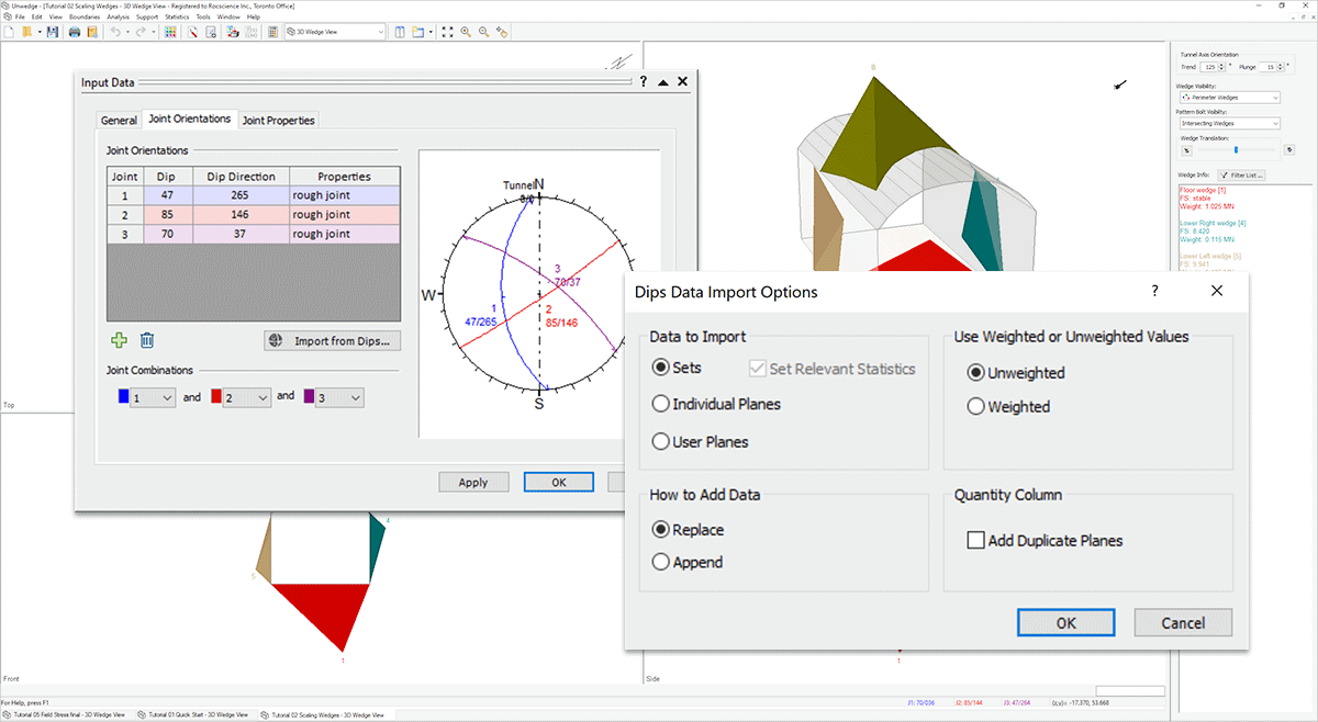
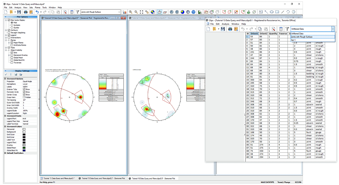
Import joint orientations from Dips. If data is measured and recorded along boreholes or scanlines, you can import the orientation and location of individual planes. If joint sets exist, use set statistics of mean dip and dip direction and Fisher K to define synthetic joint set orientation distributions.

Dips

+

ShapeMetriX's powerful joint modelling and structural mapping features are now integrated with Dips. Analyze custom *.3gdps files, containing key joint information like dip, dip direction, location, and persistence, all within the intuitive Dips interface.

Dips

The Latest Features

Learn more about all the new features in the latest release of Dips. Read article
  • Dynamic Data Filters

    Create multiple data filter queries in the same Dips file and display dynamically filtered data and analysis results in any view (such as Grid Data, 2D Stereonet Plot, 3D Stereonet, and Chart). Quickly create a new Dips file with a selected filter.

  • Kinematic Sensitivity

    Vary kinematic properties (such as slope dip, slope dip direction, friction angle, and lateral limits) when analyzing sliding and toppling failure modes to visualize their effects on the number of kinematically critical vectors and intersections.

  • 2D Stereonets View Templates

    Efficiently save and load custom plot options and display settings to and from any stereonet plot view using the View Templates feature.

Dynamic Data Filter
Kinematic Sensitivity Image
2D Stereonets View Templates Image

Grow With Our Learning Resources

Explore our Learning Resources and User Guides, designed to help you excel with all of your geotechnical projects, whether you are a practicing engineer, an academic or a student.
Article thumbnail Dips Import Wizard
article

Dips Gets the Need For Speed With New Import Wizard

Article thumbnail Joint Effort Dips S Wedge
article

A Joint Effort: Analyzing Rock Slopes with Dips and SWedge

Cappadocia case study feature web
article

Can Secondary Toppling Failure Analysis Save Cappadocia’s Ignimbrites?

Dips

Get Dips today. Choose your license below:

Personal Lease

USD / year
  • One Seat
  • One User Device
  • Cloud-Hosted Licensing
  • Managed in the RocPortal

Flexible Lease

USD / year
  • Multiple Seats
  • 5 User Devices Per Seat
  • Cloud-Hosted Licensing
  • Managed in the RocPortal
If you’re interested in hosting your flexible lease licenses on a local server, contact us.
Have questions about our pricing structure? View Plans & Pricing FAQ