Integration of Radar Data in Slide3 and RS3 Slope Stability Modeling

Rocscience has partnered with IDS GeoRadar to integrate deformation monitoring data from IDS’ slope monitoring radars into slope stability numerical models in Slide3 and RS3. This integration is a first in the industry, pioneering new ways for radar data to support numerical modeling.
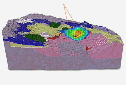
As seen in Figure 1, the upcoming releases of Slide3 and RS3 will enable overlay of radar maps onto model results using geo-reference data imported from IDS GeoRadar interferometric radars capable of capturing deformations over the entire slope every minute with the newest ArcSAR technology.

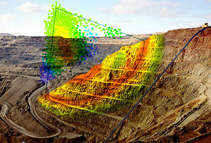
As shown in Figure 2, radar data will be integrated through a streamlined workflow that will enable geotechnical engineers to focus on slope modeling and analysis instead of wasting time on importing and converting files.

Expect to see the integration of radar monitoring data in Slide3 and RS3 in the upcoming 2019 releases.