RocFall2 Analysis: Part of a Safe Mine Re-entry Plan
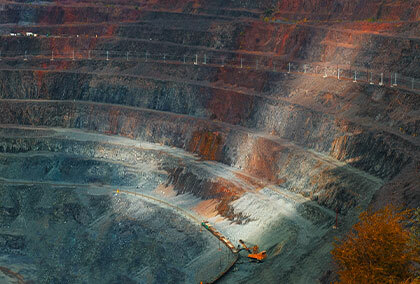
Slope Failure at an Open Pit Coal Mine
This paper details an open pit coal mine in Alberta, Canada where two slope failures occurred, one on July 9th,2017, and a larger one on August 5th, 2017. Operations were suspended until an appropriate re-entry plan could be developed and executed.
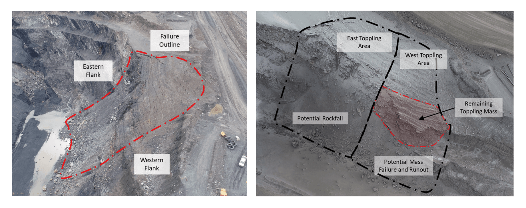
RocFall2 was used to analyze the slope failure in the eastern section of the remaining hazard area which was still at risk for rock failure after the initial two failures. With the results of the rockfall analysis paired with RS2’s overall slope stability analysis, the re-entry plan was implemented successfully allowing the mine to resume its operations.
The Southern Highwall
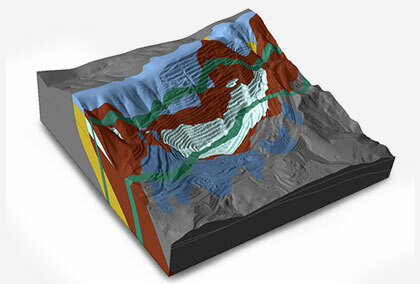
The section of slope that failed was approximately 60 meters tall and made up of interbedded sediments including sandstone, siltstone, shale and mudstone, limestone and conglomerate. These sediments dipped into the high wall at angles between 50 and 65 degrees.
Using RocFall2
In the case of the south highwall failure, RocFall2 was used to calibrate the model-based using on the observed runoff distances of rock. It was then used to evaluate the optimal size and location to implement the containment berm at the toe of the slope.
Back Analysis
Two cross-sections of the South highwall were selected and the following parameters can be seen in Figure 2.
- The first section was through the eastern rockfall hazard area and the other was through the western hazard area at risk for rock toppling.
- The slope was divided into different materials used for modeling:
- bedrock at the crest of the slope
- fine to very coarse talus in the upper talus material
- compacted soil to rock at the toe of the slope
It is important to note that a seeder was placed near the crest of the slope in addition to this a rotational velocity of -20 degrees/second was applied.
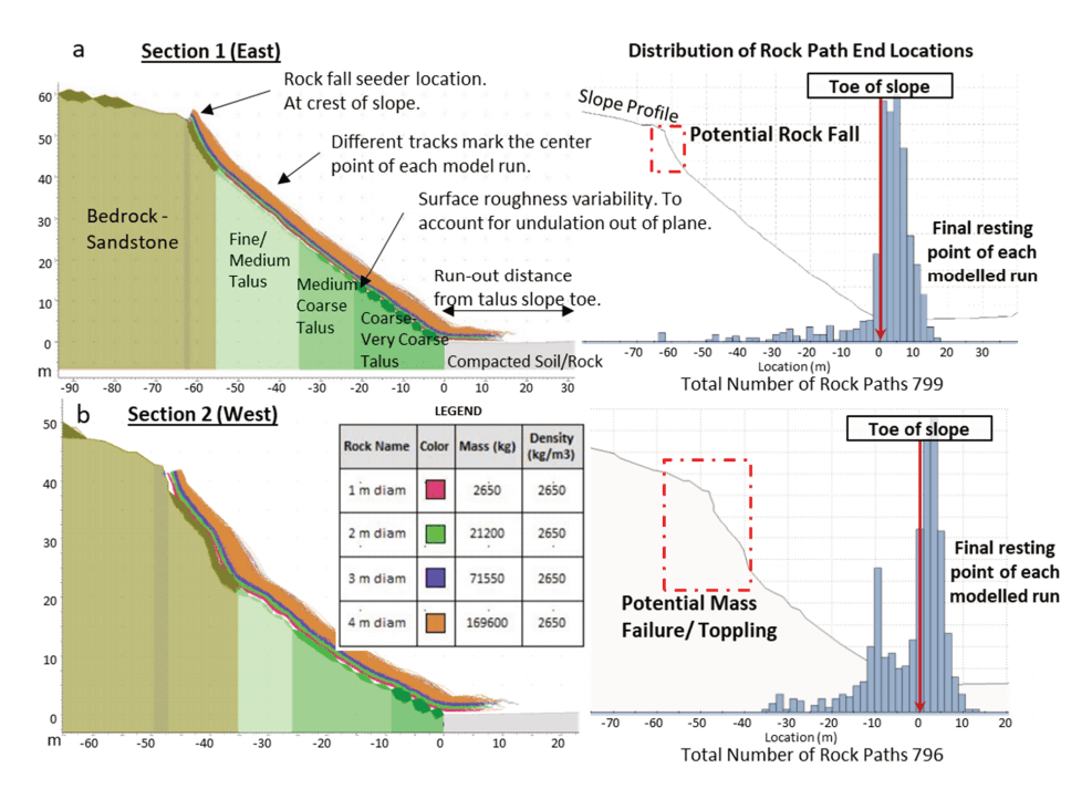
An iterative approach was used for the back analysis to calculate the model parameters by matching them with the observed rockfall to calibrate the model. The toe of the slope was set to 0 meters and multiple iterations were run until the results of the back analysis matched the observed runout distance where most of the rock debris terminated within 10 meters from the talus of the slope (Figure 2).
Forward Analysis
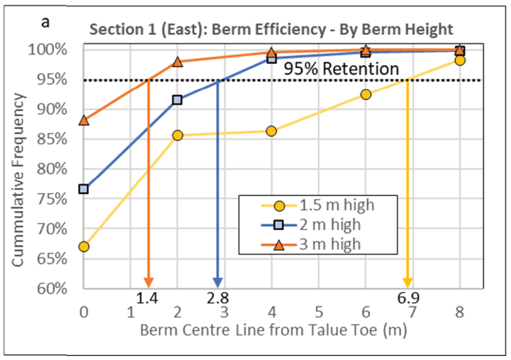
Three berm heights were tested: 1.5, 2, and 3-meters, for their effectiveness at stopping potential rockfalls. The purpose was to select the berm height which would allow for maximum coal extraction while maintaining a target containment rate of 95%. The further the berm is placed from the talus, the more cost-effective it would be to install, however, less coal would be accessible. Berms closer to the talue toe would take more time and money to construct but allow for more access to the remaining coal. The results of the forward analysis are represented in Figure 3, suggesting that either a 2m berm placed 4m from the slope’s toe or a 3m berm, 3m from the toe, would be sufficient in achieving over a 95% retention rate.
This case study demonstrates how RocFall2, an industry-tested tool, can provide valuable insight into past slope failures and can be used to model scenarios leading to safe and reliable barrier design.
Take a look at how RS2 played a role in this mine re-entry plan or read the full case study by C. Clayton.